
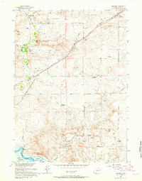
1950 Map of Amend Ranch
USGS Topo · Published 1950About this map
Family-named ranches anchor this high-plains landscape as it appeared at mid-century, reflecting the enduring cattle and sheep operations of eastern Wyoming. The terrain is marked by the drainages of Lost Creek in the north and Muddy Creek to the south, with the Converse Co Niobrara Co boundary line bisecting the eastern portion of the survey. Remote outposts such as the Amend Ranch, York Ranch, and Moore Ranch are connected by a network of unimproved roads and dotted with numerous Windmills, essential for livestock survival in this semi-arid environment. Local history and genealogy are preserved at the Prairie View Cem near the eastern edge, while other family holdings like the Ray Reese Ranch and Reese Bros Ranch illustrate the settlement patterns of a region where the ranch was the center of community life.
Find a feature on this map
12 named features on this map. Tap any name to fly to it.
Don’t see what you’re looking for? This feature index may not catch every label — zoom into the map to look around manually.
Map Details
Editions of this 1950 Amend Ranch Map
This is the sole edition of this map. No revisions or reprints were ever made.
Other maps of this area

1949 · Shawnee
USGS Topo · 1:24,000

1949 · Cedar Top
USGS Topo · 1:24,000

1950 · Glendo
USGS Topo · 1:24,000

1950 · Cedar Top
USGS Topo · 1:24,000

1950 · Prairie View School
USGS Topo · 1:24,000

1950 · Shawnee
USGS Topo · 1:24,000

1950 · Jewel Springs
USGS Topo · 1:24,000

1954 · Torrington
USGS Topo · 1:250,000

1958 · Torrington
USGS Topo · 1:250,000
1961 · Shawnee
USGS Topo · 1:24,000