
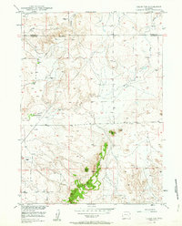
1949 Map of Cedar Top
USGS Topo · Published 1963About this map
The Spanish Diggings occupy the high ground in the northern reaches of this 1949 survey, marking a landscape defined by significant geologic and prehistoric activity. Stretching across the border of Niobrara and Platte counties, the terrain is characterized by prominent elevations such as Sheep Mountain and the distinct volcanic or erosional forms of Cedar Top and Pin Top.
Find a feature on this map
12 named features on this map. Tap any name to fly to it.
Don’t see what you’re looking for? This feature index may not catch every label — zoom into the map to look around manually.
Map Details
Editions of this 1949 Cedar Top Map
2 editions found
Other maps of this area

1896 · Hartville
USGS Topo · 1:125,000

1901 · Hartville
USGS Topo · 1:125,000

1950 · Amend Ranch
USGS Topo · 1:24,000

1950 · Cedar Top
USGS Topo · 1:24,000

1950 · Prairie View School
USGS Topo · 1:24,000

1950 · Jewel Springs
USGS Topo · 1:24,000

1950 · Haushar Ranch
USGS Topo · 1:24,000

1950 · Hell Gap
USGS Topo · 1:24,000

1951 · Haushar Ranch
USGS Topo · 1:24,000
1951 · Hell Gap
USGS Topo · 1:24,000