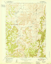
1951 Map of Hell Gap
USGS Topo · Published 1951About this map
The Wild Cat Hills dominate this portion of the Wyoming landscape, where the rugged topography transitions between Platte and Goshen counties. In the early 1950s, the area remained defined by scattered family holdings and livestock operations, evidenced by the presence of the Old 4J Ranch, Brownrigg Ranch, and the Kimble Ranch. The isolation of the terrain is reflected in the infrastructure of the period; the Patten Creek Sch is already noted as abandoned, and the Greenhope Mine stands silent to the east.
Find a feature on this map
19 named features on this map. Tap any name to fly to it.
Don’t see what you’re looking for? This feature index may not catch every label — zoom into the map to look around manually.
Map Details
Editions of this 1951 Hell Gap Map
This is the sole edition of this map. No revisions or reprints were ever made.
Other maps of this area

1896 · Hartville
USGS Topo · 1:125,000

1901 · Hartville
USGS Topo · 1:125,000

1949 · Cedar Top
USGS Topo · 1:24,000

1950 · Cedar Top
USGS Topo · 1:24,000

1950 · Guernsey
USGS Topo · 1:24,000

1950 · Casebier Hill
USGS Topo · 1:24,000

1950 · Haushar Ranch
USGS Topo · 1:24,000

1950 · Hell Gap
USGS Topo · 1:24,000

1950 · Guernsey Reservoir
USGS Topo · 1:24,000

1951 · Haushar Ranch
USGS Topo · 1:24,000