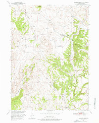
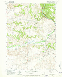
1950 Map of Haushar Ranch
USGS Topo · Published 1976About this map
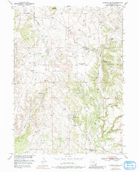
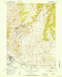
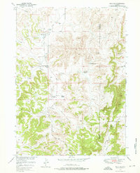
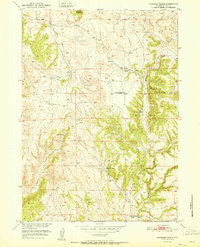
Haushar Ranch and several other family-named landholdings define the mid-century landscape of this Wyoming cattle country. Mapped in 1948 and field-checked in 1950, the area is characterized by a network of drainage systems including Boxelder Creek, Deep Creek, and Broom Creek that carve through the high plains terrain. The presence of the Canyon View School (Abandoned) and the Ferguson Ranch (Abandoned) points to a period of consolidation or shifting settlement patterns following the early ranching era. Notable topographic markers like Sheep Mtn and the steep walls of Sawmill Canyon provide clear orientation for researchers tracing the historical boundaries of the McNutt Ranch or the Osborn Ranch. The survey highlights a landscape where vital water sources and schoolhouses served as the primary hubs for a dispersed ranching population.
Find a feature on this map
18 named features on this map. Tap any name to fly to it.
Don’t see what you’re looking for? This feature index may not catch every label — zoom into the map to look around manually.
Map Details
Editions of this 1950 Haushar Ranch Map
2 editions found
Other maps of this area

1896 · Hartville
USGS Topo · 1:125,000

1901 · Hartville
USGS Topo · 1:125,000
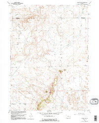
1949 · Cedar Top
USGS Topo · 1:24,000

1950 · Cedar Top
USGS Topo · 1:24,000

1950 · Jewel Springs
USGS Topo · 1:24,000
1950 · Guernsey
USGS Topo · 1:24,000
1950 · Herman Ranch
USGS Topo · 1:24,000
1950 · Hell Gap
USGS Topo · 1:24,000
1950 · Guernsey Reservoir
USGS Topo · 1:24,000
1951 · Haushar Ranch
USGS Topo · 1:24,000