
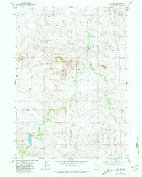
1970 Map of Keeline
USGS Topo · Published 1973About this map
The Chicago and North Western railroad corridor anchors the southern edge of this high-plains landscape, where the small settlement of Keeline serves as a lone hub of activity in Niobrara County. The terrain is defined by a series of prominent topographic landmarks, including the high ridges of the Harney Hills, the Chalk Buttes, and Chimney Rock. These elevations give way to extensive drainage systems such as Golden Draw and Sothman Draw, which feed into the wider basin of Lance Creek and Little Lightning Creek.
Find a feature on this map
15 named features on this map. Tap any name to fly to it.
Don’t see what you’re looking for? This feature index may not catch every label — zoom into the map to look around manually.
Map Details
Editions of this 1970 Keeline Map
This is the sole edition of this map. No revisions or reprints were ever made.
Other maps of this area

1950 · Amend Ranch
USGS Topo · 1:24,000

1950 · Prairie View School
USGS Topo · 1:24,000

1954 · Torrington
USGS Topo · 1:250,000

1958 · Torrington
USGS Topo · 1:250,000

1970 · Lost Springs
USGS Topo · 1:24,000

1970 · Lost Springs NW
USGS Topo · 1:24,000

1970 · Cooley Draw
USGS Topo · 1:24,000

1974 · Lone Tree Hill
USGS Topo · 1:24,000

1981 · Bills Creek
USGS Topo · 1:24,000
1981 · Flat Top
USGS Topo · 1:24,000