
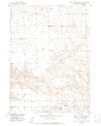
1950 Map of Prairie View School
USGS Topo · Published 1950About this map
The high plains of Niobrara County, Wyoming, are defined here by a network of ranching homesteads and drainage basins. Surveyed just after World War II, the landscape is dotted with functional infrastructure necessary for survival in this arid environment, including numerous Windmills and a prominent Pipe Line running through the eastern sections. Central to the local community was the Prairie View Sch, which served the families of the various cattle operations established throughout the territory.
Find a feature on this map
15 named features on this map. Tap any name to fly to it.
Don’t see what you’re looking for? This feature index may not catch every label — zoom into the map to look around manually.
Map Details
Editions of this 1950 Prairie View School Map
2 editions found
Other maps of this area

1949 · Cedar Top
USGS Topo · 1:24,000

1950 · Amend Ranch
USGS Topo · 1:24,000

1950 · Cedar Top
USGS Topo · 1:24,000

1950 · Jewel Springs
USGS Topo · 1:24,000

1954 · Torrington
USGS Topo · 1:250,000

1958 · Torrington
USGS Topo · 1:250,000
1961 · Jewel Springs
USGS Topo · 1:24,000

1970 · Lost Springs
USGS Topo · 1:24,000

1970 · Keeline
USGS Topo · 1:24,000

1974 · Lone Tree Hill
USGS Topo · 1:24,000