
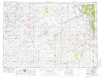
1955 Map of Newcastle
USGS Topo · Published 1963About this map
Newcastle serves as a central hub in this high-plains landscape, where the Black Hills National Forest rises to the northeast. The region is defined by a sparse but vital network of cattle ranches and industrial sites, including the Mush Creek Pumping Station and several Oil Fields near Lance Creek. The Chicago Burlington & Quincy RR provides a critical transport artery, connecting settlements like Upton, Osage, and Edgemont.
Find a feature on this map
107 named features on this map. Tap any name to fly to it.
Don’t see what you’re looking for? This feature index may not catch every label — zoom into the map to look around manually.
Map Details
Editions of this 1955 Newcastle Map
2 editions found
Other maps of this area

1894 · Deadwood
USGS Topo · 1:125,000

1896 · Harney Peak
USGS Topo · 1:125,000

1898 · Sundance
USGS Topo · 1:125,000

1899 · Newcastle
USGS Topo · 1:125,000

1901 · Harney Peak
USGS Topo · 1:125,000

1901 · Deadwood
USGS Topo · 1:125,000

1901 · Newcastle
USGS Topo · 1:125,000

1902 · Sundance
USGS Topo · 1:125,000

1902 · Edgemont
USGS Topo · 1:125,000

1916 · Deadwood
USGS Topo · 1:125,000