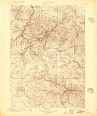
1916 Map of Deadwood
USGS Topo · Published 1916About this map
Deadwood and Lead anchor a complex landscape of extraction and transport in the northern Black Hills, captured here during a pivotal era of industrial mining. The narrow-gauge and standard-gauge routes of the Burlington and Missouri River RR and the Northwestern Line weave through deep gulches to serve booming mining camps like Terraville, Central City, and Maitland. To the east, the Fort Meade Military Reservation stands near Sturgis, while the southern reaches of the map transitions into the high plateaus of the Black Hills National Forest. Genealogists and historians can trace the specific locations of early 20th-century operations like the Omega Mine and the Gold Dirt Mine, alongside numerous named gulches and mountain peaks including Custer Peak and Elkhorn Peak.
Find a feature on this map
112 named features on this map. Tap any name to fly to it.
Don’t see what you’re looking for? This feature index may not catch every label — zoom into the map to look around manually.
Map Details
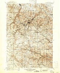
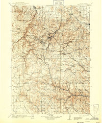
Editions of this 1916 Deadwood Map
3 editions found
Other maps of this area

1893 · Rapid
USGS Topo · 1:125,000

1894 · Deadwood
USGS Topo · 1:125,000

1894 · Hermosa
USGS Topo · 1:125,000

1896 · Harney Peak
USGS Topo · 1:125,000

1898 · Sundance
USGS Topo · 1:125,000

1898 · Rapid
USGS Topo · 1:125,000

1899 · Sturgis
USGS Topo · 1:62,500

1899 · Newcastle
USGS Topo · 1:125,000

1900 · Spearfish
USGS Topo · 1:62,500

1901 · Hermosa
USGS Topo · 1:125,000