Old Maps of Lawrence County, South Dakota
Explore 143 old maps of Lawrence County, spanning from 1893 to today. These high-resolution historic maps reveal how streets, neighborhoods, landmarks, and natural features evolved over time — perfect for genealogy, metal detecting, research, and local history exploration.
What you can do with these maps:
- See how Lawrence County changed over time: Compare historical maps to modern-day views to trace roads, homesites, rail lines & more.
- View detailed metadata: Each map includes creators, publishers, year, scale, and archive source.
- Overlay maps with satellite & LiDAR: Visualize the past alongside modern tools to explore terrain & human change.
- Trusted historical sources: Maps sourced from the USGS, Library of Congress, and other archives.
- Access maps your way: View online, download high-res files, or order prints for personal or research use.
Start exploring old maps of Lawrence County to uncover forgotten places, hidden landmarks, and the deep history beneath your feet.
Lawrence County, SD maps
(143)- 1893 Map of Rapid
 1893 Rapid1893 Print · USGSThe Black Hills frontier comes alive in the late nineteenth century as rail lines and military outposts shape the territory. Genealogists and researchers can trace the early layout of Rapid, locate Fort Meade, and find family-named landmarks like Doe Dotie Ranch or Piedmont.2 unique versions available
 - 1894 Map of Deadwood
 1894 Deadwood1894 Print · USGSThe Black Hills gold mining region is documented here in the early 1890s, capturing the industrial density of Deadwood and Lead. Researchers can trace early rail lines and find specific mountain locations like the Normal School in Spearfish, Bull Dog Ranch, and Lookout Mill.2 unique versions available
 - 1898 Map of Sundance
 1898 Sundance1898 Print · USGSNorthwestern Wyoming and the Black Hills border come alive in the 1890s, when Sundance served as a key regional hub. Genealogists and local historians can trace early wagon routes connecting settlements like Manhattan, Welcome, and Inyankara.
 - 1898 Map of Rapid
 1898 Rapid1898 Print · USGSThe Black Hills foothills come alive in the 1890s, where early railroads meet military outposts and pioneer settlements. Trace the early streets of Rapid City, the grounds of Fort Meade, and localized landmarks like Crystal Cave.2 unique versions available
 - 1899 Map of Sturgis
 1899 Sturgis1899 Print · USGSThe Black Hills region thrives in the late nineteenth century as mining and rail lines connect the foothills to the mountains. Trace the early growth of Sturgis and Deadwood alongside landmarks like the Fort Meade Timber Reservation and Whitewood.2 unique versions available
 - 1900 Map of Spearfish
 1900 Spearfish1900 Print · USGSThe Black Hills gold and timber country comes alive in this late nineteenth-century survey of Lawrence County. Trace the early railroad networks of the Deadwood Central and locate mountain camps like Greenmont P.O. and Terry.
 - 1901 Map of Deadwood
 1901 Deadwood1901 Print · USGSThe Black Hills gold mining region and the bustling camps of Lawrence County are captured here just before the modern era. Genealogists and historians can trace the early rail networks of the Burlington and Missouri River Railroad through remote outposts like Bulldog Ranch and Rochford.2 unique versions available
 - 1901 Map of Aladdin, 1954 Print
 1901 Aladdin1954 Print · USGSCrook County ranching and rail life at the turn of the century is preserved here, from the mountain slopes to the river valleys. Genealogists can trace early homesteads and shipping points like Aladdin, Beulah, and the VVV Ranch.
 - 1902 Map of Sundance
 1902 Sundance1902 Print · USGSThe Wyoming and South Dakota borderlands come into focus at the turn of the century as ranching and early mining outposts take hold. Genealogists and historians can trace family-named sites like Mc Creadys Ranch and early settlements including Manhattan and Buckhorn.4 unique versions available
 - 1903 Map of Aladdin
 1903 Aladdin1903 Print · USGSThe northern Black Hills region at the turn of the century reveals a landscape defined by the arrival of the Wyoming and Missouri River R.R. and expansive cattle ranching. Researchers can trace the early footprints of settlements like Aladdin and Beulah, alongside established landmarks like the VVV Ranch and Schoolmarm Butte.3 unique versions available
 - 1903 Map of Rapid
 1903 Rapid1903 Print · USGSThe Black Hills transition from mountains to plains at the turn of the century, centered on the growing rail hub of Rapid. Researchers can trace the early rail corridor of the Fremont Elkhorn and Missouri Valley through Fort Meade and Piedmont.4 unique versions available
 - 1905 Map of Saint Onge
 1905 Saint Onge1905 Print · USGSWestern South Dakota's ranching and rail landscape comes into focus at the dawn of the twentieth century. Researchers can trace the Chicago and Northwestern Ry through Saint Onge or locate early water projects like the Redwater Ditch and the settlement at Snoma.2 unique versions available
 - 1907 Map of Belle Fourche
 1907 Belle Fourche1907 Print · USGSEarly ranching and rail development in the Black Hills foothills appear here in the first decade of the 1900s. Researchers can trace the legacy of cattle country through family-named sites like O Connors Ranch and the early settlements of Minnesela and Saint Onge.2 unique versions available
 - 1907 Map of Redwater
 1907 Redwater1907 Print · USGSBelle Fourche and the surrounding Black Hills foothills are documented here at the height of the early rail era. Researchers can trace the original routes of the Chicago and Northwestern RR and locate early sites like Minnesela and Concordia.2 unique versions available
 - 1915 Map of Spearfish
 1915 Spearfish1915 Print · USGSLawrence County in the early twentieth century is a landscape of gold mining camps and mountain railroads. Genealogists and historians can trace the foundations of Lead and Spearfish, or find now-quiet locations like Homestake Camp and Carbonate.2 unique versions available
 - 1915 Map of Sturgis
 1915 Sturgis1915 Print · USGSThe Black Hills were a hub of mining and military activity in the early twentieth century. Researchers can trace the rail lines of the Chicago and Northwestern and locate specialized sites like the Golden Crest Mine and the Fort Meade Military Reservation.2 unique versions available
 - 1916 Map of Deadwood
 1916 Deadwood1916 Print · USGSThe Black Hills mining district at the peak of its early industrial era shows a dense network of rail and timber camps. Researchers can trace the narrow-gauge C B & Q RR lines to the Queen Bee Mine and the Fort Meade Military Reservation.3 unique versions available
 - 1953 Map of Piedmont, 1955 Print
 1953 Piedmont1955 Print · USGSThe eastern front of the Black Hills is captured here during the mid-1950s as the rail-driven community of Piedmont meets the canyon lands. Researchers can trace deep-woods landmarks like Stagebarn Caverns, the Pinkerton Sch, and numerous mountain springs from Dody Spring to Dalton Lake.5 unique versions available
 - 1953 Map of Nemo, 1955 Print
 1953 Nemo1955 Print · USGSIn the heart of the Black Hills in the early fifties, this area was defined by remote forest settlements and mining claims. Genealogists and historians can trace old landmarks like the Hillside Sch, the Lucky Strike Mine, and the local Cem near Nemo.5 unique versions available
 - 1953 Map of Tilford, 1955 Print
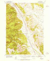 1953 Tilford1955 Print · USGSThe Black Hills foothills in the early fifties show a landscape of military boundaries, national forest lands, and railroad transit. Trace the historic route of the Chicago and North Western through Tilford or locate the Upper Pleasant Valley Sch and Black Hills National Cemetery.4 unique versions available
 - 1953 Map of Rapid City, 1964 Print
 1953 Rapid City1964 Print · USGSWestern South Dakota's transition from the Black Hills to the open prairie is captured here during the mid-fifties. Researchers can trace the development of Ellsworth Air Force Base alongside historic landmarks like Bear Butte and the Lower Alkali School.3 unique versions available
 - 1954 Map of Deadman Mountain, 1955 Print
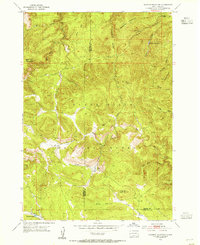 1954 Deadman Mountain1955 Print · USGSThe Black Hills interior is captured here in the mid-1950s, revealing a rugged expanse across the Lawrence and Meade county lines. Researchers can trace deep drainage systems and mountain landmarks like Deadman Mountain, the Veteran Lookout Tower, and Wonderland Cave.5 unique versions available
 - 1954 Map of Sturgis, 1955 Print
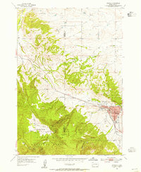 1954 Sturgis1955 Print · USGSSturgis and the eastern Black Hills are captured here during the mid-fifties, showing the town as a vital regional hub. Researchers can trace the Chicago and North Western rail line and locate rural landmarks like Merritt Sch and Granite Peak.3 unique versions available
 - 1954 Map of Saint Onge SE, 1955 Print
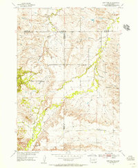 1954 Saint Onge SE1955 Print · USGSThe rolling ranchlands of Meade and Lawrence counties are captured in the mid-1950s, highlighting a network of rural schoolhouses. Genealogists can locate family landmarks like Big Bottom Sch, Oakdale Sch, and the prominent Snake Bench.4 unique versions available
 - 1954 Map of Saint Onge, 1955 Print
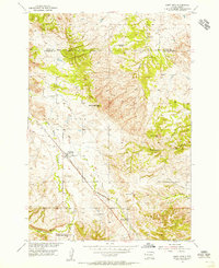 1954 Saint Onge1955 Print · USGSLawrence County saw steady ranching and rail activity during the mid-fifties as the Missouri River Basin program advanced. Genealogists can trace family footprints through sites like the Saint Onge Cem, the Dane Ch, and the Middle False Bottom Sch.3 unique versions available
Showing maps 1-25 of 143
Top cities of Lawrence County
- Spearfish historical maps
- Lead historical maps
- North Spearfish historical maps
- Deadwood historical maps
- Whitewood historical maps
- Mountain Plains historical maps
See more
Frequently asked questions
- What are the different types of historical maps available for Lawrence County?
- What is the oldest map of Lawrence County?
- Where can I purchase historical maps of Lawrence County for my home or office?
- Where can I download high-res historical maps of Lawrence County?
- Are there historical topographic maps available for Lawrence County?
- Is there historical aerial imagery available for Lawrence County?
- Where are historical maps of Lawrence County sourced from?