2020s Maps of Lawrence County, South Dakota
Explore 22 historic maps of Lawrence County from the 2020s. These maps offer a rare glimpse into what life looked like during the 2020s — showing old roads, neighborhoods, homes, and landmarks that have changed or disappeared over time.
Whether you're researching your family's past, planning a metal detecting trip, or studying how Lawrence County's landscape evolved across the 2020s, these high-resolution maps are a powerful tool for exploring the history of this region.
- Focus on a specific era: All maps on this page are from the 2020s, giving you a focused view of this time period.
- See what’s changed: Compare century-old streets, trails, and buildings to today's modern landscape using overlays and satellite layers.
- Research with precision: Use these maps for genealogy, historical research, land use analysis, or educational projects.
- View, download, or print: Maps are fully viewable online in high resolution, and can be downloaded or printed for your own records.
Start exploring Lawrence County's history through authentic maps from the 2020s. This is your window into the past.
Lawrence County, SD maps
(22)- 2021 Map of Old Baldy Mountain, 2021 Print
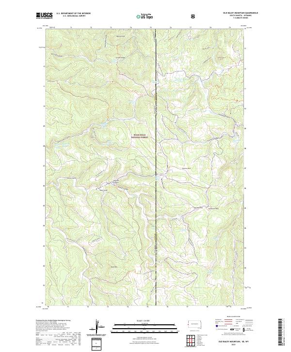 2021 Old Baldy Mountain2021 Print · USGSThe Black Hills high country on the South Dakota and Wyoming border is captured here in modern detail. Researchers can locate critical water sources like Lone Grave Spring and Balm of Gilead Spring or trace the canyons around Old Baldy Mtn.
 - 2021 Map of Tinton, 2021 Print
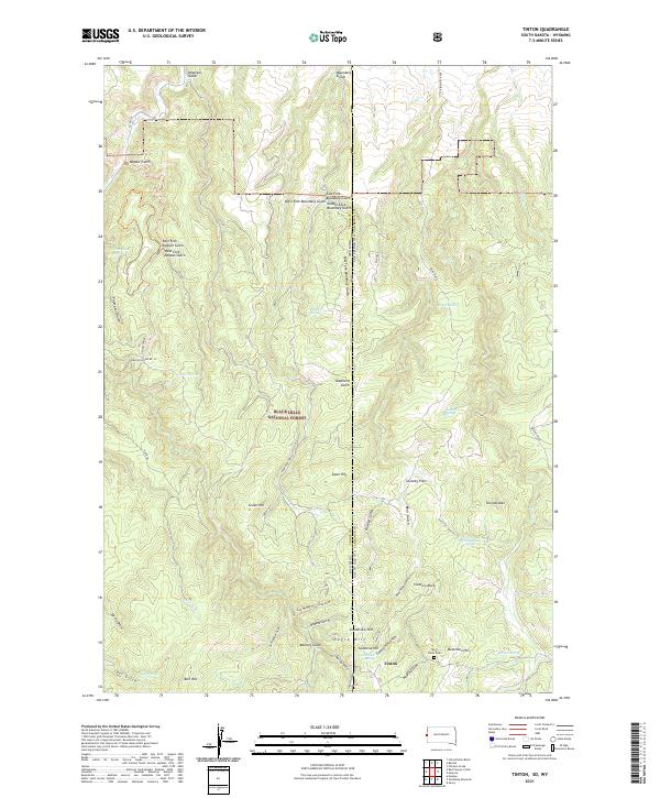 2021 Tinton2021 Print · USGSThe Black Hills highlands along the South Dakota and Wyoming border come into focus in this contemporary survey of the area around the old mining camp of Tinton. Researchers can trace local history through features like the Bear Gulch Cem, The Needles, and Beartown Hill.
 - 2021 Map of Nemo, 2021 Print
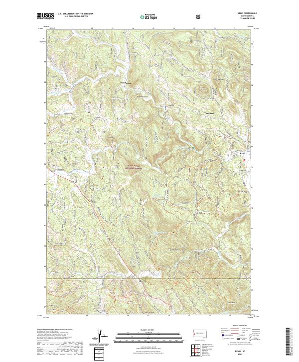 2021 Nemo2021 Print · USGSThe Black Hills highlands are shown here in the early twenty-first century, mapping a landscape of isolated mountain communities and dense forest service networks. Researchers can locate remote sites like Benchmark and Novak, or trace routes along Boxelder Cr and the Nemo Cem.
 - 2021 Map of Lead, 2021 Print
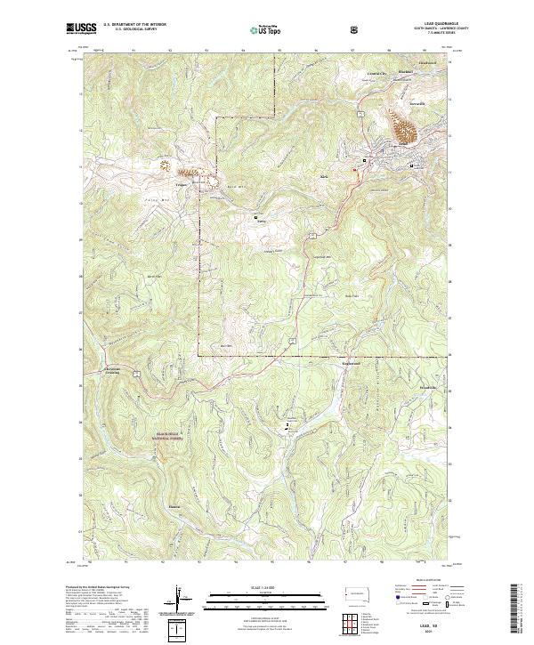 2021 Lead2021 Print · USGSMining history and high-altitude terrain define this 2021 survey of the Black Hills near Lead and Deadwood. Genealogists and historians can trace cemetery locations like Holy Cross Cem or follow the historic rail path of the George S. Mickelson Trl.
 - 2021 Map of Crooks Tower, 2021 Print
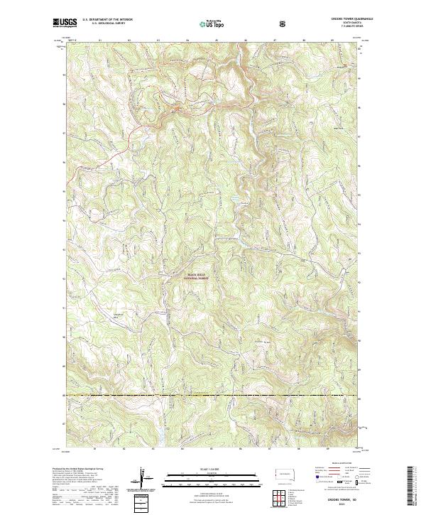 2021 Crooks Tower2021 Print · USGSHigh in the Black Hills during the early 2020s, this forest survey documents the remote backcountry along the Lawrence and Pennington county line. Hikers and researchers can trace the intricate Eagle Cliff trail system or locate named water sources like Potato Spring and Yellow Jacket Spring.
 - 2021 Map of Deadman Mountain, 2021 Print
 2021 Deadman Mountain2021 Print · USGSThe Black Hills interior on the Lawrence and Meade county line is captured here in the early twenty-first century. Researchers can trace forest management and mountain landmarks from Deadman Mtn to the Sturgis Reservoirs and the sprawling Big Elk Burn.
 - 2021 Map of Saint Onge SE, 2021 Print
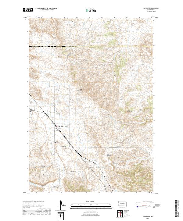
 2021 Saint Onge SE2021 Print · USGSThe rural borders of Meade, Lawrence, and Butte counties are captured here in the early twenty-first century. Researchers can trace land divisions and water sources across Snake Bench and along the banks of Whitewood Cr and Crow Cr.
 - 2021 Map of Spearfish, 2021 Print
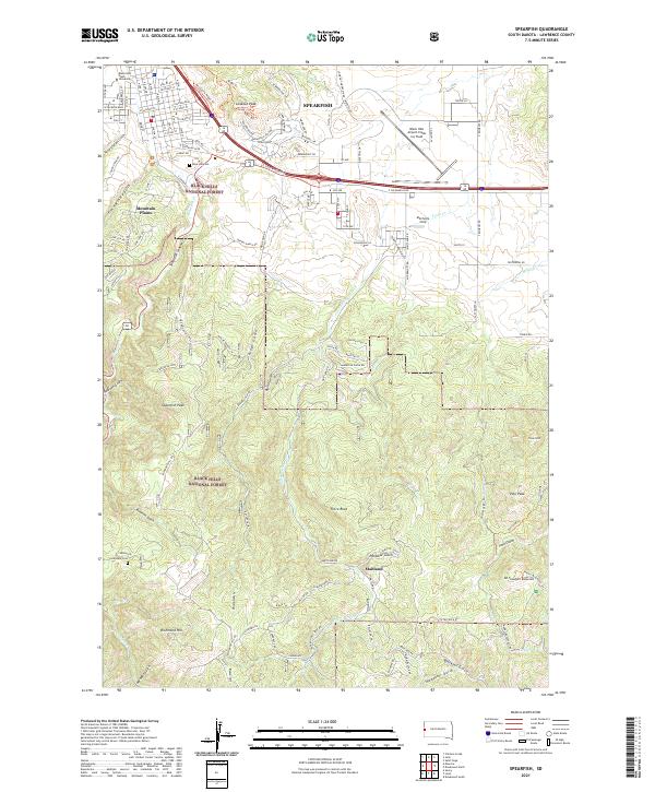 2021 Spearfish2021 Print · USGSSpearfish and the northern Black Hills are captured here at the start of the 2020s, showing the intersection of university life and mountain terrain. Researchers can locate family sites at Rose Hill Cem, the historic Maitland settlement, and Carbonate Cem.
 - 2021 Map of Maurice, 2021 Print
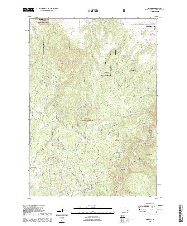 2021 Maurice2021 Print · USGSLawrence County's high-country terrain is captured in this recent survey, showing the deep drainages of the Black Hills as they appear today. Researchers can trace the winding route through Spearfish Canyon or locate specific landmarks like Bridal Veil Falls, Citadel Rock, and the settlement of Maurice.
 - 2021 Map of Tilford, 2021 Print
 2021 Tilford2021 Print · USGSThe Meade County landscape is shown in detail here during the twenty-first century. Genealogists and historians can trace family-named sites and landmarks like Black Hills National Cemetery and Blucksberg Mountain.
 - 2021 Map of Sturgis, 2021 Print
 2021 Sturgis2021 Print · USGSThe Black Hills foothills meet the town of Sturgis in the early 2020s, revealing a landscape defined by both modern growth and deep-rooted landmarks. Researchers can locate the Meade County Courthouse and trace local genealogy at Crook City Cem or Saint Aloysius Cem.
 - 2021 Map of Deadwood South, 2021 Print
 2021 Deadwood South2021 Print · USGSLawrence County's mining and forest history comes alive in this contemporary view of the northern Black Hills. Genealogists and historians can trace the legacy of old mining towns at Galena and Roubaix, or locate family sites near the Galena Cem.
 - 2021 Map of Savoy, 2021 Print
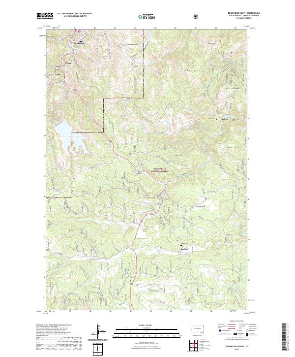
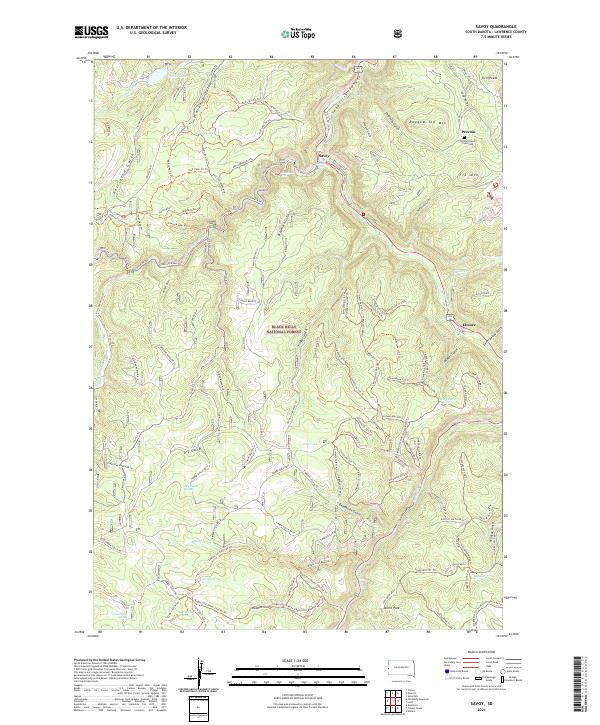 2021 Savoy2021 Print · USGSThe northern Black Hills in Lawrence County are shown here at the start of the 2020s, dominated by steep canyons and high-altitude springs. Genealogists and hikers can trace the site of Preston, locate the Preston Ghost Town Cem, and follow trails like the Eagle Cliff Roller Coaster Trl.
 - 2021 Map of Saint Onge, 2021 Print
 2021 Saint Onge2021 Print · USGSThe ranching and upland country of Lawrence County is shown here in the early 2020s, centered on the historic community of St. Onge. Genealogists can locate several local burial grounds including Little Dane Cem and Rodeo Grounds Cem near Saint Onge Peak.
 - 2021 Map of Piedmont, 2021 Print
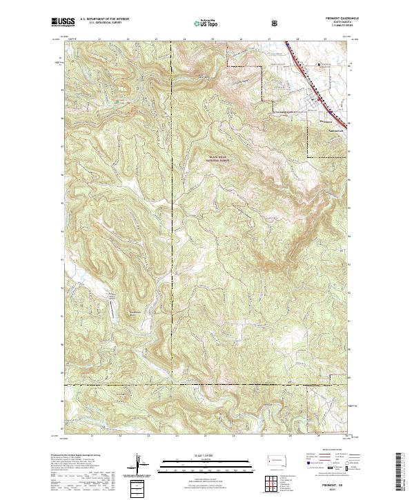 2021 Piedmont2021 Print · USGSThe Black Hills foothills meet the prairie in this recent survey of the Piedmont area. Genealogists and hikers can trace local landmarks like the Piedmont Cemetery, the heights of Green Mountain, and the winding Centennial Trail.
 - 2021 Map of Jolly, 2021 Print
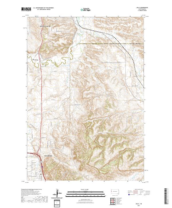 2021 Jolly2021 Print · USGSThe Black Hills foothills meet the South Dakota plains in the early 2020s, revealing a landscape defined by river valleys and rising summits. Trace the historical alignment of the Old Belle Hwy and identify property landmarks like Jolly and the Concordia Ditch.
 - 2021 Map of Minnesota Ridge, 2021 Print
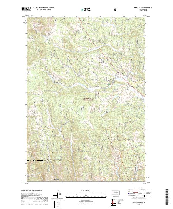 2021 Minnesota Ridge2021 Print · USGSThe Black Hills high country comes into focus in this recent survey, centered on the rugged spine of Minnesota Ridge. Researchers can trace old family sites and mountain routes near Rochford, the Mountain Meadow Cemetery, and Roubaix Lake.
 - 2021 Map of Nahant, 2021 Print
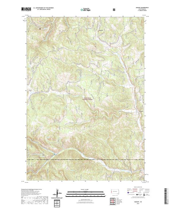 2021 Nahant2021 Print · USGSThe Black Hills National Forest straddles the Lawrence and Pennington county line in this contemporary topographic study. Researchers can trace the layout of mountain settlements like Nahant and Dumont or locate local landmarks like Carr Cem and Besant Park.
 - 2021 Map of Chicken Creek, 2021 Print
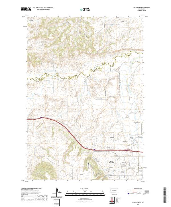 2021 Chicken Creek2021 Print · USGSThe northern edge of the Black Hills meets the South Dakota prairie in the early 2020s, centered on the growing community of Spearfish. Researchers can trace old water rights and land use through named irrigation works like Cook Ditch or find family landmarks along Higgins Gulch and Redwater River.
 - 2021 Map of Deadwood North, 2021 Print
 2021 Deadwood North2021 Print · USGSThe Black Hills northern gateway comes alive in this contemporary record of its mining and ranching heritage. Genealogists and historians can trace the family legacies at Mount Moriah Cem and Oak Ridge Cem, or explore the old routes through Crook City and Whitewood.
 - 2021 Map of Buckhorn, 2021 Print
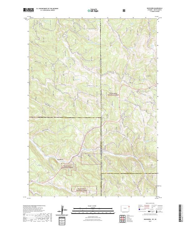 2021 Buckhorn2021 Print · USGSThe Wyoming and South Dakota borderlands come alive in this modern survey of the high-elevation Black Hills. Researchers can trace forest access routes and water sources like Buckhorn, O'Neil Pass, and the seasonal paths of Snow-3 Trl.
 - 2021 Map of Beulah, 2021 Print
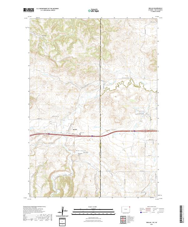 2021 Beulah2021 Print · USGSThe Wyoming and South Dakota borderlands come into focus in this recent survey of the Black Hills foothills. Genealogists and local historians can trace family locations near the Beulah Cem or follow the historic route of Old US Hwy 14 past Montana Lake.
End of results
Showing maps 1-22 of 22
Top cities of Lawrence County
- Spearfish historical maps
- Lead historical maps
- North Spearfish historical maps
- Deadwood historical maps
- Whitewood historical maps
- Mountain Plains historical maps
See more
Frequently asked questions
- What are the different types of historical maps available for Lawrence County?
- What is the oldest map of Lawrence County?
- Where can I purchase historical maps of Lawrence County for my home or office?
- Where can I download high-res historical maps of Lawrence County?
- Are there historical topographic maps available for Lawrence County?
- Is there historical aerial imagery available for Lawrence County?
- Where are historical maps of Lawrence County sourced from?