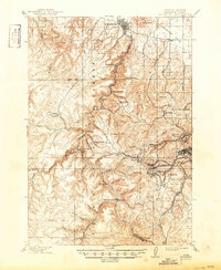
1900 Map of Spearfish
USGS Topo · Published 1900About this map
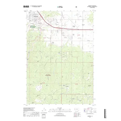
Spearfish serves as the northern gateway to the deep canyons and high peaks of the Black Hills Forest Reserve at the close of the 19th century. This survey documents a critical period of industrial development, where a complex network of narrow and standard-gauge lines, including the Deadwood Central R. R. and the Spearfish Branch of the Burlington and Missouri River R. R., weave through the gulches to service mining communities. The terrain is a maze of named landmarks like Terry Peak and Ragged Top Mt., surrounding mountain settlements such as Portland, Terry, and Greenmont P.O.. At Cheyenne Crossing, the geography transitions toward the Limestone Plateau, while the rugged descent of Little Spearfish Creek toward Spearfish Falls highlights the dramatic elevation changes that defined the region's transport and timber economies.
Find a feature on this map
100 named features on this map. Tap any name to fly to it.
Don’t see what you’re looking for? This feature index may not catch every label — zoom into the map to look around manually.
Map Details
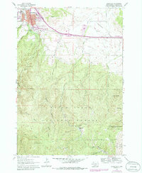
Editions of this 1900 Spearfish Map
This is the sole edition of this map. No revisions or reprints were ever made.
Historical Maps of Spearfish Through Time
7 maps found