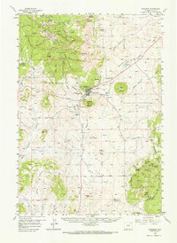
1902 Map of Sundance
USGS Topo · Published 1902About this map
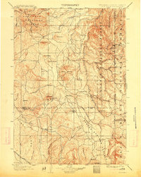
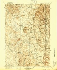
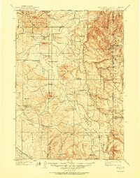
Sundance serves as the focal point for this early 20th-century survey of the Wyoming and South Dakota borderlands, where the Bear Lodge Mountains rise sharply against the horizon. The landscape is defined by its early mining and ranching history, visible in the clusters of activity around Mineral Hill, Nigger Hill, and the scattered family outposts such as Mc Creadys Ranch and Holwell Ranch. The northeastern portion of the sheet is dominated by the Black Hills Forest Reserve, showing the transition from the peaks of Warren Peaks to the deep cuts of Grand Canyon.
Find a feature on this map
57 named features on this map. Tap any name to fly to it.
Don’t see what you’re looking for? This feature index may not catch every label — zoom into the map to look around manually.
Map Details
Editions of this 1902 Sundance Map
4 editions found
Historical Maps of Sundance Through Time
4 maps found