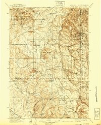
1902 Map of Sundance
USGS Topo · Published 1939About this map
Sundance serves as the primary hub in this early twentieth-century survey of the high plains and mountain transitions where Wyoming meets South Dakota. The landscape is defined by the Black Hills National Forest and a series of prominent peaks including Inyan Kara Mtn and the Warren Peaks. Mining activity is evident on the eastern edge of the map, centered around Mineral Hill, Welcome, and the Tinton mine site.
Find a feature on this map
62 named features on this map. Tap any name to fly to it.
Don’t see what you’re looking for? This feature index may not catch every label — zoom into the map to look around manually.
Map Details
Editions of this 1902 Sundance Map
4 editions found
Other maps of this area

1894 · Deadwood
USGS Topo · 1:125,000

1896 · Harney Peak
USGS Topo · 1:125,000

1898 · Sundance
USGS Topo · 1:125,000

1899 · Newcastle
USGS Topo · 1:125,000

1900 · Spearfish
USGS Topo · 1:62,500

1901 · Harney Peak
USGS Topo · 1:125,000

1901 · Deadwood
USGS Topo · 1:125,000

1901 · Newcastle
USGS Topo · 1:125,000

1901 · Aladdin
USGS Topo · 1:125,000

1902 · Sundance
USGS Topo · 1:125,000