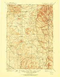
1902 Map of Sundance
USGS Topo · Published 1951About this map
Sundance serves as the focal point of this regional study, situated within the Black Hills National Forest along the Wyoming-South Dakota border. Surveyed at the turn of the century by H. S. Wallace and W. H. Herron, the terrain is defined by the prominent Bear Lodge Mountains and iconic landmarks like Inyan Kara Mtn. and Sundance Min.. The map documents a landscape transitioning from an open frontier to a settled ranching and mining district, evidenced by numerous named homesteads such as Mc Creadys Ranch and the Hotwell Ranch.
Find a feature on this map
69 named features on this map. Tap any name to fly to it.
Don’t see what you’re looking for? This feature index may not catch every label — zoom into the map to look around manually.
Map Details
Editions of this 1902 Sundance Map
4 editions found
Other maps of this area

1894 · Deadwood
USGS Topo · 1:125,000

1896 · Harney Peak
USGS Topo · 1:125,000

1898 · Sundance
USGS Topo · 1:125,000

1899 · Newcastle
USGS Topo · 1:125,000

1900 · Spearfish
USGS Topo · 1:62,500

1901 · Harney Peak
USGS Topo · 1:125,000

1901 · Deadwood
USGS Topo · 1:125,000

1901 · Newcastle
USGS Topo · 1:125,000

1901 · Aladdin
USGS Topo · 1:125,000

1902 · Sundance
USGS Topo · 1:125,000