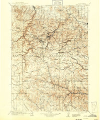
1916 Map of Deadwood
USGS Topo · Published 1943About this map
The mining centers of Lead and Deadwood dominate this survey of the northern Black Hills, showing the complex industrial and residential patterns established by the early 20th century. High-altitude settlements like Terraville and Cyanide are linked to the major hubs via the Chicago Burlington and Quincy RR, which winds through narrow gulches and over the Limestone Plateau. To the east, the Fort Meade Timber Reservation sits adjacent to Sturgis, while the southern portion of the map reveals a landscape of isolated camps and mills such as Rochford, Mystic, and Lookout Mills. The map captures a transition from heavy extraction to early forest management within the Black Hills National Forest, with dozens of named peaks like Terry Peak and Custer Peak serving as landmarks for the scattered mining claims and homesteads found along South Fork Rapid Creek.
Find a feature on this map
95 named features on this map. Tap any name to fly to it.
Don’t see what you’re looking for? This feature index may not catch every label — zoom into the map to look around manually.
Map Details
Editions of this 1916 Deadwood Map
3 editions found

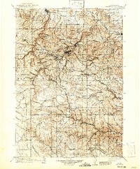
Other maps of this area

1893 · Rapid
USGS Topo · 1:125,000

1894 · Deadwood
USGS Topo · 1:125,000

1894 · Hermosa
USGS Topo · 1:125,000

1896 · Harney Peak
USGS Topo · 1:125,000

1898 · Sundance
USGS Topo · 1:125,000

1898 · Rapid
USGS Topo · 1:125,000

1899 · Sturgis
USGS Topo · 1:62,500

1899 · Newcastle
USGS Topo · 1:125,000

1900 · Spearfish
USGS Topo · 1:62,500

1901 · Hermosa
USGS Topo · 1:125,000