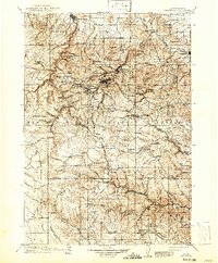
1916 Map of Deadwood
USGS Topo · Published 1941About this map
Deadwood and Lead anchor this detailed 1916 survey of South Dakota's mining heartland, updated to reflect revisions through 1913. The map traces the industrial footprint of the northern Black Hills, where the Northwestern Line and Burlington railroads snake through gulches to serve booming gold camps. Settlements like Terraville, Central City, and Maitland are densely packed near the headwaters of Whitewood Creek, illustrating the concentrated extraction and processing centers that defined the era.
Find a feature on this map
138 named features on this map. Tap any name to fly to it.
Don’t see what you’re looking for? This feature index may not catch every label — zoom into the map to look around manually.
Map Details
Editions of this 1916 Deadwood Map
3 editions found

Other maps of this area

1893 · Rapid
USGS Topo · 1:125,000

1894 · Deadwood
USGS Topo · 1:125,000

1894 · Hermosa
USGS Topo · 1:125,000

1896 · Harney Peak
USGS Topo · 1:125,000

1898 · Sundance
USGS Topo · 1:125,000

1898 · Rapid
USGS Topo · 1:125,000

1899 · Sturgis
USGS Topo · 1:62,500

1899 · Newcastle
USGS Topo · 1:125,000

1900 · Spearfish
USGS Topo · 1:62,500

1901 · Hermosa
USGS Topo · 1:125,000