1950s Maps of Clark, Wyoming
Explore 3 historic maps of Clark from the 1950s. These maps offer a rare glimpse into what life looked like during the 1950s — showing old roads, neighborhoods, homes, and landmarks that have changed or disappeared over time.
Whether you're researching your family's past, planning a metal detecting trip, or studying how Clark's landscape evolved across the 1950s, these high-resolution maps are a powerful tool for exploring the history of this region.
- Focus on a specific era: All maps on this page are from the 1950s, giving you a focused view of this time period.
- See what’s changed: Compare century-old streets, trails, and buildings to today's modern landscape using overlays and satellite layers.
- Research with precision: Use these maps for genealogy, historical research, land use analysis, or educational projects.
- View, download, or print: Maps are fully viewable online in high resolution, and can be downloaded or printed for your own records.
Start exploring Clark's history through authentic maps from the 1950s. This is your window into the past.
Clark, WY maps
(3)- 1950 Map of Clark, 1952 Print
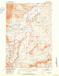 1950 Clark1952 Print · USGSNorthern Wyoming ranching and early petroleum development meet here at the start of the 1950s. Researchers can trace family homesteads like Johnson Ranch and locate local landmarks including Clark Sch and the Clark Cem.3 unique versions available
 - 1955 Map of Cody, 1969 Print
 1955 Cody1969 Print · USGSThe Bighorn Basin and Absaroka Range meet in the mid-fifties, capturing a landscape defined by mountain wilderness and burgeoning oil fields. Trace family roots in Cody or Meeteetse, and locate industrial landmarks like the Elk Basin Oil and Gas Field and the Chicago Burlington and Quincy RR.2 unique versions available
 - 1958 Map of Cody
 1958 Cody1958 Print · USGSNorthwestern Wyoming at the peak of the mid-century energy and ranching boom shows a land of high peaks and oil basins. Researchers can trace the Chicago Burlington and Quincy rail lines through Greybull or locate the sprawling Elk Basin Oil and Gas Field.
End of results
Showing maps 1-3 of 3
Frequently asked questions
- What are the different types of historical maps available for Clark?
- What is the oldest map of Clark?
- Where can I purchase historical maps of Clark for my home or office?
- Where can I download high-res historical maps of Clark?
- Are there historical topographic maps available for Clark?
- Is there historical aerial imagery available for Clark?
- Where are historical maps of Clark sourced from?