Old Maps of Bordeaux, Wyoming for Genealogy
Trace your family roots with 8 historic maps of Bordeaux. These high-res maps reveal old neighborhoods, homesites, landmarks, and streets — helping you uncover where your ancestors lived and how the area evolved over time.
- Explore historic neighborhoods: Identify where your relatives may have lived in the 1800s or 1900s.
- Compare maps over time: Trace the changes in streets, buildings, and landmarks for multi-generational research.
- Perfect for genealogy & ancestry research: Used by family historians and researchers to map out lineage and migration.
These maps are an incredible resource for exploring your personal connection to Bordeaux's past.
Bordeaux, WY maps
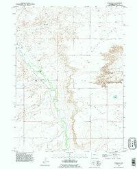
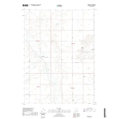
(8)- 1953 Map of Bordeaux, 1954 Print
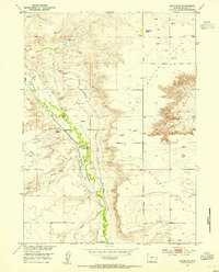 1953 Bordeaux1954 Print · USGSPlatte County ranching and rail history intersect here in the early fifties along the Colorado and Southern line. Researchers can locate the L D Ranch Old Stage Coach Station (Historical) and family landmarks like Phillippi Ranch or Wedemeyer Ranch.2 unique versions available
 - 1954 Map of Cheyenne, 1963 Print
 1954 Cheyenne1963 Print · USGSSoutheastern Wyoming's high plains and the capital city's mid-century expansion are documented here during the early Cold War. Genealogists and historians can trace rail-aligned settlements like Pine Bluffs and Hillsdale, or explore landmarks like the Ames Monument and Francis E. Warren Air Force Base.3 unique versions available
 - 1958 Map of Cheyenne
 1958 Cheyenne1958 Print · USGSSoutheast Wyoming and the Nebraska border appear in the late 1950s as a hub of military defense and rail commerce. Genealogists can trace the Union Pacific through Cheyenne or locate the Horse Creek Oil Field and the State Capitol.2 unique versions available
 - 1990 Map of Bordeaux, 1995 Print
 1990 Bordeaux1995 Print · USGSThe high plains of Platte County come into focus in the 1990s as a landscape shaped by ranching and vital watercourses. Genealogists and local historians can locate legacy operations like Phillips Ranch and M Bar Ranch near the waters of Chugwater Creek.
 - 2012 Map of Bordeaux, 2012 Print
 2012 Bordeaux2012 Print · USGSCovers Bordeaux, including Platte County, United States, and other nearby areas
 - 2015 Map of Bordeaux, 2015 Print
 2015 Bordeaux2015 Print · USGSCovers Bordeaux, including Platte County, United States, and other nearby areas
 - 2017 Map of Bordeaux, 2017 Print
 2017 Bordeaux2017 Print · USGSCovers Bordeaux, including Platte County, United States, and other nearby areas
 - 2021 Map of Bordeaux, 2021 Print
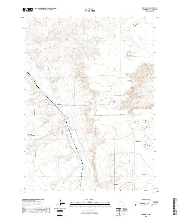 2021 Bordeaux2021 Print · USGSBordeaux and the high plains of Platte County are captured here during the early twenty-first century. Genealogists and local historians can trace the rural landscape from Slater Flats to the Goshen Hole Rim, locating landmarks like Chug Spring and Slater.
End of results
Showing maps 1-8 of 8
Top cities near Bordeaux
Frequently asked questions
- What are the different types of historical maps available for Bordeaux?
- What is the oldest map of Bordeaux?
- Where can I purchase historical maps of Bordeaux for my home or office?
- Where can I download high-res historical maps of Bordeaux?
- Are there historical topographic maps available for Bordeaux?
- Is there historical aerial imagery available for Bordeaux?
- Where are historical maps of Bordeaux sourced from?