1900s (20th Century) Maps of Cassa, Wyoming
Explore 7 historic maps of Cassa from the 1900s (20th Century). These maps offer a rare glimpse into what life looked like during the 1900s — showing old roads, neighborhoods, homes, and landmarks that have changed or disappeared over time.
Whether you're researching your family's past, planning a metal detecting trip, or studying how Cassa's landscape evolved across the 1900s, these high-resolution maps are a powerful tool for exploring the history of this region.
- Focus on a specific era: All maps on this page are from the 1900s, giving you a focused view of this time period.
- See what’s changed: Compare century-old streets, trails, and buildings to today's modern landscape using overlays and satellite layers.
- Research with precision: Use these maps for genealogy, historical research, land use analysis, or educational projects.
- View, download, or print: Maps are fully viewable online in high resolution, and can be downloaded or printed for your own records.
Start exploring Cassa's history through authentic maps from the 1900s. This is your window into the past.
Cassa, WY maps
(7)- 1901 Map of Hartville
 1901 Hartville1901 Print · USGSEastern Wyoming at the turn of the century reveals a landscape defined by the arrival of the rails and the legacy of the frontier. Genealogists can trace family ranching sites like Dotys Ranch or early towns such as Hartville and Fort Laramie.2 unique versions available
 - 1952 Map of Cassa
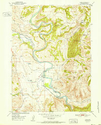 1952 Cassa1952 Print · USGSThe North Platte River valley in the early fifties shows a landscape shaped by ranching and rail. Genealogists and researchers can trace family-named sites like Millikin Ranch and Sullivan Place or locate the Mountain View School.
 - 1954 Map of Torrington, 1963 Print
 1954 Torrington1963 Print · USGSEastern Wyoming and the Nebraska borderlands are captured here during the mid-fifties, showing a landscape shaped by the Platte River and the Laramie Range. Researchers can trace deep history at the Fort Laramie National Historical Site, the Old Doty Ranch Site, and along the Old Fetterman Road.4 unique versions available
 - 1958 Map of Torrington
 1958 Torrington1958 Print · USGSEastern Wyoming and the Nebraska borderlands are captured in the late fifties, showcasing a landscape of high plains ranching and river-fed industry. Trace the historic paths of the Union Pacific railroad and find legacy sites like Fort Laramie and Sunrise.
 - 1961 Map of Cassa, 1965 Print
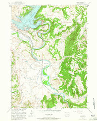 1961 Cassa1965 Print · USGSThe North Platte River corridor is seen here in the early sixties, just as the new reservoir and dam were reshaping the local topography. Genealogists and historians can trace the historic Emigrant Trail and the Chicago Burlington and Quincy rail line near Cassa.3 unique versions available
 - 1978 Map of Torrington
 1978 Torrington1978 Print · USGSSoutheast Wyoming in the late seventies reveals a landscape shaped by the North Platte River and a dense network of major rail lines. Researchers can locate the Fort Laramie National Historic Site, the Camp Guernsey Training Area, and original stops along the Union Pacific railroad.2 unique versions available
 - 1990 Map of Cassa, 1995 Print
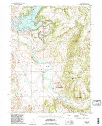 1990 Cassa1995 Print · USGSThe North Platte River valley in Platte County is captured here in the 1990s as it flows past the Camp Guernsey State Military Reservation. Researchers can trace the historic Emigrant Trail or locate family landmarks like Haushar Ranch and the settlement of Cassa.
End of results
Showing maps 1-7 of 7
Top cities near Cassa
Frequently asked questions
- What are the different types of historical maps available for Cassa?
- What is the oldest map of Cassa?
- Where can I purchase historical maps of Cassa for my home or office?
- Where can I download high-res historical maps of Cassa?
- Are there historical topographic maps available for Cassa?
- Is there historical aerial imagery available for Cassa?
- Where are historical maps of Cassa sourced from?