Old Maps of Phifer Ranch, Wyoming
Explore 11 old maps of Phifer Ranch, spanning from 1896 to today. These high-resolution historic maps reveal how streets, neighborhoods, landmarks, and natural features evolved over time — perfect for genealogy, metal detecting, research, and local history exploration.
What you can do with these maps:
- See how Phifer Ranch changed over time: Compare historical maps to modern-day views to trace roads, homesites, rail lines & more.
- View detailed metadata: Each map includes creators, publishers, year, scale, and archive source.
- Overlay maps with satellite & LiDAR: Visualize the past alongside modern tools to explore terrain & human change.
- Trusted historical sources: Maps sourced from the USGS, Library of Congress, and other archives.
- Access maps your way: View online, download high-res files, or order prints for personal or research use.
Start exploring old maps of Phifer Ranch to uncover forgotten places, hidden landmarks, and the deep history beneath your feet.
Phifer Ranch, WY maps
(11)- 1896 Map of Hartville
 1896 Hartville1896 Print · USGSSoutheast Wyoming in the late nineteenth century was a territory of vital river crossings and early industry. Researchers can trace the junction of the Laramie River and North Platte River near Fort Laramie and locate early rail hubs at Wheatland and Wendover.
 - 1901 Map of Hartville
 1901 Hartville1901 Print · USGSEastern Wyoming at the turn of the century reveals a landscape defined by the arrival of the rails and the legacy of the frontier. Genealogists can trace family ranching sites like Dotys Ranch or early towns such as Hartville and Fort Laramie.2 unique versions available
 - 1951 Map of Wheatland, 1952 Print
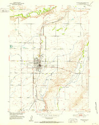 1951 Wheatland1952 Print · USGSMid-century Platte County is defined here by its rail-and-water network as the town of Wheatland expands along the Burlington Route. Genealogists and historians can trace family ranch sites like Phifer Ranch and local hubs like the Moody Community Club or Whiting.2 unique versions available
 - 1954 Map of Torrington, 1963 Print
 1954 Torrington1963 Print · USGSEastern Wyoming and the Nebraska borderlands are captured here during the mid-fifties, showing a landscape shaped by the Platte River and the Laramie Range. Researchers can trace deep history at the Fort Laramie National Historical Site, the Old Doty Ranch Site, and along the Old Fetterman Road.4 unique versions available
 - 1958 Map of Torrington
 1958 Torrington1958 Print · USGSEastern Wyoming and the Nebraska borderlands are captured in the late fifties, showcasing a landscape of high plains ranching and river-fed industry. Trace the historic paths of the Union Pacific railroad and find legacy sites like Fort Laramie and Sunrise.
 - 1978 Map of Torrington
 1978 Torrington1978 Print · USGSSoutheast Wyoming in the late seventies reveals a landscape shaped by the North Platte River and a dense network of major rail lines. Researchers can locate the Fort Laramie National Historic Site, the Camp Guernsey Training Area, and original stops along the Union Pacific railroad.2 unique versions available
 - 1990 Map of Wheatland, 1995 Print
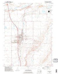 1990 Wheatland1995 Print · USGSWheatland and its surrounding ranchlands are captured here in the 1990s as the town matured into a regional agricultural center. Genealogists and local historians can trace family-named sites like Bard Ranch and Phifer Ranch or locate burials at Wheatland Cemetery.
 - 2012 Map of Wheatland, 2012 Print
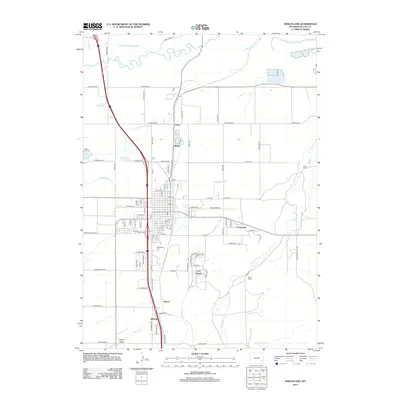 2012 Wheatland2012 Print · USGSCovers Phifer Ranch, including Wheatland, Whiting, and other nearby areas
 - 2015 Map of Wheatland, 2015 Print
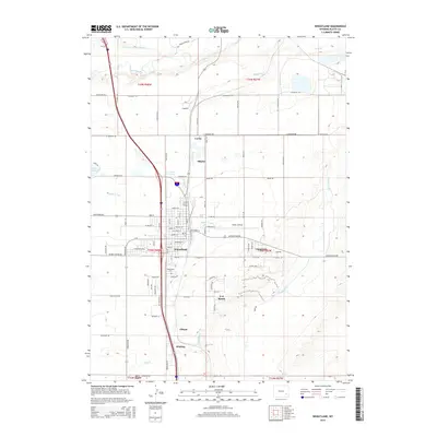 2015 Wheatland2015 Print · USGSCovers Phifer Ranch, including Wheatland, Whiting, and other nearby areas
 - 2018 Map of Wheatland, 2018 Print
 2018 Wheatland2018 Print · USGSCovers Phifer Ranch, including Wheatland, Whiting, and other nearby areas
 - 2021 Map of Wheatland, 2021 Print
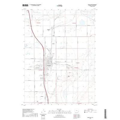
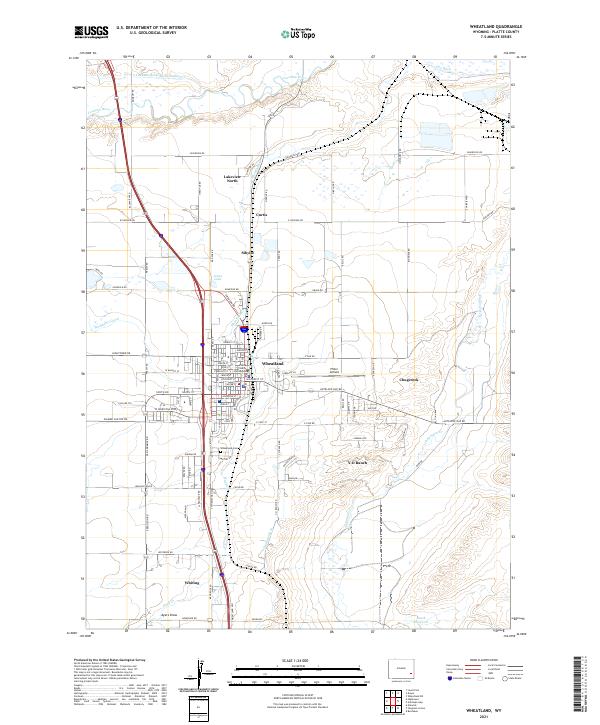 2021 Wheatland2021 Print · USGSWheatland and its surrounding high-plains agricultural landscape are documented in this recent survey. Researchers can trace the sophisticated irrigation network of the Laramie River, identifying the Platte County Courthouse and the Wheatland Cem.
End of results
Showing maps 1-11 of 11
Top cities near Phifer Ranch
Frequently asked questions
- What are the different types of historical maps available for Phifer Ranch?
- What is the oldest map of Phifer Ranch?
- Where can I purchase historical maps of Phifer Ranch for my home or office?
- Where can I download high-res historical maps of Phifer Ranch?
- Are there historical topographic maps available for Phifer Ranch?
- Is there historical aerial imagery available for Phifer Ranch?
- Where are historical maps of Phifer Ranch sourced from?