
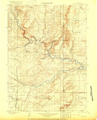
1901 Map of Hartville
USGS Topo · Published 1901About this map
North Platte River and Laramie River dominate this 1901 survey of eastern Wyoming, where the converging paths of several railroads define the early development of the region. The map shows the Burlington and Missouri River R.R. and the Colorado and Southern R.R. threading through the canyons of the Haystack Range. Settlements such as Hartville and Guernsey are established at these rail junctures, while older frontier sites like Fort Laramie remain as important landmarks along the riverbank. The landscape is dotted with early ranching operations, including Dotys Ranch, 4 J Ranch, and Waterhole Ranch, alongside the Government Farm. To the south, the Wheatland Canal No. 2 signifies the introduction of irrigation systems near Wheatland, as the territory transitioned from a ranching frontier to a more structured agricultural and mining economy.
Find a feature on this map
44 named features on this map. Tap any name to fly to it.
Don’t see what you’re looking for? This feature index may not catch every label — zoom into the map to look around manually.
Map Details
Editions of this 1901 Hartville Map
2 editions found
Other maps of this area

1896 · Patrick
USGS Topo · 1:125,000

1896 · Hartville
USGS Topo · 1:125,000

1899 · Goshen Hole
USGS Topo · 1:125,000

1949 · Cedar Top
USGS Topo · 1:24,000

1950 · Glendo
USGS Topo · 1:24,000

1950 · Cedar Top
USGS Topo · 1:24,000

1950 · Jewel Springs
USGS Topo · 1:24,000

1950 · Rockeagle
USGS Topo · 1:24,000

1950 · Guernsey
USGS Topo · 1:24,000

1950 · Casebier Hill
USGS Topo · 1:24,000