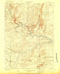
1901 Map of Hartville
USGS Topo · Published 1922About this map
Hartville and the nearby mining community of Sunrise serve as the focal points for this region at the turn of the century. The map illustrates a complex convergence of rail and river geography, where the Colorado and Southern RR and Burlington and Missouri River RR trace the winding path of the North Platte River. The presence of Fort Laramie on the river's southern bank highlights the area's military and frontier significance, while the establishment of Wheatland to the southwest points toward the expansion of early irrigation projects like Wheatland Canal No. 2.
Find a feature on this map
44 named features on this map. Tap any name to fly to it.
Don’t see what you’re looking for? This feature index may not catch every label — zoom into the map to look around manually.
Map Details
Editions of this 1901 Hartville Map
2 editions found
Other maps of this area

1896 · Patrick
USGS Topo · 1:125,000

1896 · Hartville
USGS Topo · 1:125,000

1899 · Goshen Hole
USGS Topo · 1:125,000

1901 · Hartville
USGS Topo · 1:125,000

1949 · Cedar Top
USGS Topo · 1:24,000

1950 · Glendo
USGS Topo · 1:24,000

1950 · Cedar Top
USGS Topo · 1:24,000

1950 · Jewel Springs
USGS Topo · 1:24,000

1950 · Rockeagle
USGS Topo · 1:24,000

1950 · Guernsey
USGS Topo · 1:24,000