Old Maps of Ucross, Wyoming for Academic Research
Study the evolution of Ucross with 11 high-resolution historic maps. Whether you're teaching, researching, or modeling changes in land use, these maps provide essential visual documentation of urban, environmental, and geographic change.
- Analyze long-term change: Track patterns in development, transportation, and natural features.
- Ideal for environmental or urban studies: Support academic projects with primary historical map data.
- Use in the classroom or lab: Educators and researchers rely on these maps to bring historical context to life.
These maps are a powerful tool for teaching, research, and visualizing how Ucross has changed over the decades.
Ucross, WY maps
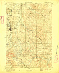
(11)- 1909 Map of Sheridan, 1954 Print
 1909 Sheridan1954 Print · USGSSheridan and the surrounding northern Wyoming ranchlands are captured here in the first decade of the twentieth century. Genealogists can trace family holdings at Wagoner Ranch or Big Red Ranch, and locate early rail stations like Verona and Ulm.2 unique versions available
 - 1911 Map of Sheridan
 1911 Sheridan1911 Print · USGSSheridan and the surrounding northern Wyoming ranchlands are captured here during a period of rapid railroad expansion. Researchers can trace the Chicago Burlington and Quincy RR through Dietz and Verona, or locate early homesteads like Wagoner Ranch.2 unique versions available
 - 1955 Map of Sheridan, 1973 Print
 1955 Sheridan1973 Print · USGSThe Bighorn Mountains meet the Powder River Basin in the 1950s, a period when cattle ranching and coal mining defined the regional economy. Genealogists and historians can trace local landmarks like the Fort Mackenzie Veteran Hospital, the Monarch Coal Mine, and legacy operations such as the Beckton Stock Farm.2 unique versions available
 - 1958 Map of Sheridan
 1958 Sheridan1958 Print · USGSThe Bighorn Mountains meet the high plains in the mid-1950s, revealing a landscape of large-scale ranching and mineral extraction. Trace the legacy of early settlements and industry through the Kleenburn Coal Tipple, Beckton Stock Farm, and the Hidden Dome Oil & Gas Field.2 unique versions available
 - 1962 Map of Sheridan
 1962 Sheridan1962 Print · USGSThe Big Horn Mountains and Powder River country are captured here in the early sixties as energy production and ranching shaped northern Wyoming. Researchers can locate specific sites like the Kleenburn Coal Tipple, Eaton Bros Ranch, and the Fort McKenzie Veteran Hospital.
 - 1970 Map of Ucross, 1973 Print
 1970 Ucross1973 Print · USGSThe confluence of Clear and Piney Creeks in the 1970s shows a landscape transformed by sophisticated ranching irrigation. Genealogists and local historians can trace the legacy of water rights through the Pratt and Ferris Ditch and the Athorpe Rogers Ditch near the settlement of Ucross.2 unique versions available
 - 1979 Map of Sheridan
 1979 Sheridan1979 Print · USGSSheridan and the surrounding ranching country are captured in the late seventies as the region balanced its frontier heritage with new energy development. Researchers can trace the path of the Burlington Northern railroad and locate historic landmarks like Massacre Hill and Lodge Trail Ridge.
 - 2012 Map of Ucross, 2012 Print
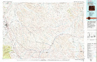
 2012 Ucross2012 Print · USGSCovers Ucross, including Sheridan County, Johnson County, and other nearby areas
 - 2015 Map of Ucross, 2015 Print
 2015 Ucross2015 Print · USGSCovers Ucross, including Sheridan County, Johnson County, and other nearby areas
 - 2017 Map of Ucross, 2017 Print
 2017 Ucross2017 Print · USGSCovers Ucross, including Sheridan County, Johnson County, and other nearby areas
 - 2021 Map of Ucross, 2021 Print
 2021 Ucross2021 Print · USGSThe confluence of Clear and Piney Creeks in northern Wyoming is captured here in a detailed modern study of ranching and irrigation. Researchers can trace the path of historic waterworks like Big Bonanza Ditch and Athoepe Rogers Ditch or find landmarks like Blazer Hill.
End of results
Showing maps 1-11 of 11
Top cities near Ucross
Frequently asked questions
- What are the different types of historical maps available for Ucross?
- What is the oldest map of Ucross?
- Where can I purchase historical maps of Ucross for my home or office?
- Where can I download high-res historical maps of Ucross?
- Are there historical topographic maps available for Ucross?
- Is there historical aerial imagery available for Ucross?
- Where are historical maps of Ucross sourced from?