2020s Maps of Evanston, Wyoming
Explore 4 historic maps of Evanston from the 2020s. These maps offer a rare glimpse into what life looked like during the 2020s — showing old roads, neighborhoods, homes, and landmarks that have changed or disappeared over time.
Whether you're researching your family's past, planning a metal detecting trip, or studying how Evanston's landscape evolved across the 2020s, these high-resolution maps are a powerful tool for exploring the history of this region.
- Focus on a specific era: All maps on this page are from the 2020s, giving you a focused view of this time period.
- See what’s changed: Compare century-old streets, trails, and buildings to today's modern landscape using overlays and satellite layers.
- Research with precision: Use these maps for genealogy, historical research, land use analysis, or educational projects.
- View, download, or print: Maps are fully viewable online in high resolution, and can be downloaded or printed for your own records.
Start exploring Evanston's history through authentic maps from the 2020s. This is your window into the past.
Evanston, WY maps
(4)- 2021 Map of Millis, 2021 Print
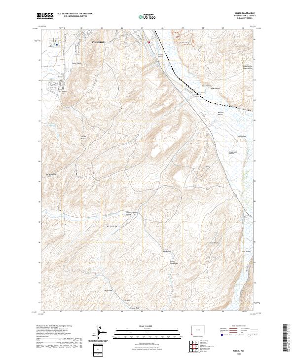 2021 Millis2021 Print · USGSThe southern outskirts of Evanston and the Bear River valley are shown here in the early twenty-first century as the city expands into traditional ranching country. Researchers can trace the modern development of local roads and find family-named landmarks like Glasscock Hollow, Stagecoach Hollow, and Knight Hollow.
 - 2021 Map of Evanston, 2021 Print
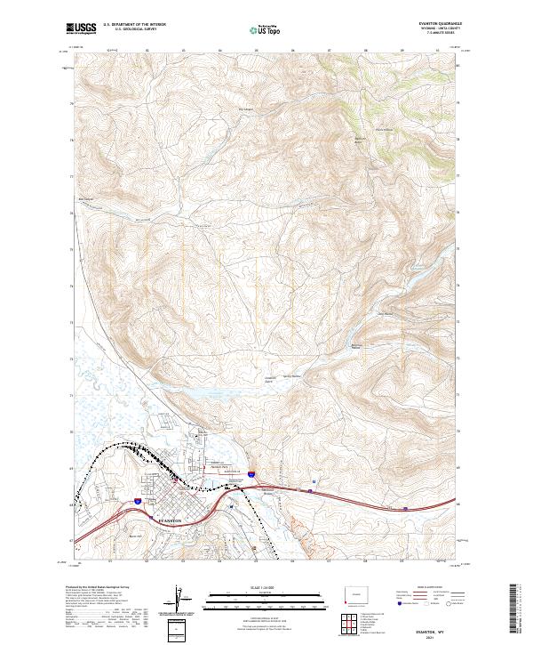 2021 Evanston2021 Print · USGSEvanston and the Bear River valley are shown in the twenty-first century, revealing a landscape defined by high-desert water management and civic growth. Researchers can trace local history through the Uinta County Courthouse, Evanston City Cem, and the path of the Old City Ditch.
 - 2023 Map of Murphy Ridge, 2023 Print
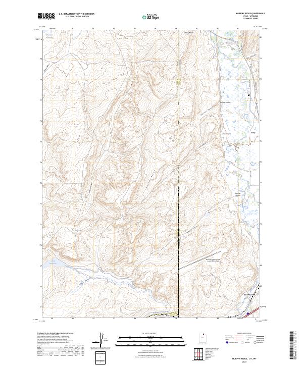 2023 Murphy Ridge2023 Print · USGSThe high borderlands of Rich County and Uinta County come to life in this contemporary study of the Utah-Wyoming state line. Genealogists and historians can trace local landmarks like Almy Cem and the Morris Ditch near the banks of the Bear River.
 - 2023 Map of Wahsatch, 2023 Print
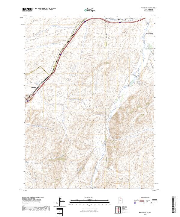 2023 Wahsatch2023 Print · USGSThe high mountain pass at Wahsatch and the outskirts of Evanston come into focus in this contemporary survey of the Utah-Wyoming border. Researchers can trace historic transit corridors like Lincoln Highway 30 and explore the rugged drainages of Echo Canyon and The Needles.
End of results
Showing maps 1-4 of 4
Top cities near Evanston
Frequently asked questions
- What are the different types of historical maps available for Evanston?
- What is the oldest map of Evanston?
- Where can I purchase historical maps of Evanston for my home or office?
- Where can I download high-res historical maps of Evanston?
- Are there historical topographic maps available for Evanston?
- Is there historical aerial imagery available for Evanston?
- Where are historical maps of Evanston sourced from?