Old Maps of Fairview, Wyoming for Genealogy
Trace your family roots with 5 historic maps of Fairview. These high-res maps reveal old neighborhoods, homesites, landmarks, and streets — helping you uncover where your ancestors lived and how the area evolved over time.
- Explore historic neighborhoods: Identify where your relatives may have lived in the 1800s or 1900s.
- Compare maps over time: Trace the changes in streets, buildings, and landmarks for multi-generational research.
- Perfect for genealogy & ancestry research: Used by family historians and researchers to map out lineage and migration.
These maps are an incredible resource for exploring your personal connection to Fairview's past.
Fairview, WY maps
(5)- 1955 Map of Newcastle, 1963 Print
 1955 Newcastle1963 Print · USGSThe high plains of eastern Wyoming and western South Dakota are captured in the mid-fifties, showing a landscape of sprawling ranches and emerging oil fields. Researchers can locate family landmarks like Saunders Ranch, trace the Chicago Burlington & Quincy RR, and explore small rail towns such as Osage and Edgemont.2 unique versions available
 - 1958 Map of Newcastle
 1958 Newcastle1958 Print · USGSThe high plains of eastern Wyoming meet the Black Hills in the late fifties, showcasing a landscape of rail-connected towns and historic trails. Trace the path of the Chicago Burlington & Quincy RR through Newcastle or locate the Bozeman Trail Monument and Summitt Ridge Lookout Tower.
 - 1979 Map of Newcastle
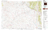 1979 Newcastle1979 Print · USGSThe energy-rich plains of Weston County meet the Black Hills in the late seventies as oil production and ranching define the landscape. Researchers can trace the Burlington Northern rail lines and explore the vast Fiddler Creek Oil Field or the remote Darlington School.
 - 1982 Map of Fairview
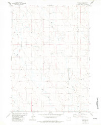 1982 Fairview1982 Print · USGSWeston County rangeland and the Fairview vicinity are captured here in the early eighties as energy exploration expanded across the landscape. Researchers can trace the watercourses of Deep Creek and Lodgepole Creek alongside numerous Drill Holes and section markers.
 - 2021 Map of Fairview, 2021 Print
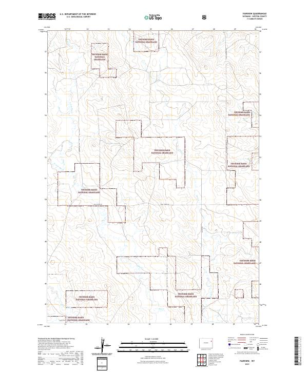 2021 Fairview2021 Print · USGSWeston County territory is shown in the modern era as a vast expanse of public land and prairie drainage. Trace the remote network of Upton Fairview Rd and Mush Creek Rd through the Thunder Basin National Grassland.
End of results
Showing maps 1-5 of 5
Frequently asked questions
- What are the different types of historical maps available for Fairview?
- What is the oldest map of Fairview?
- Where can I purchase historical maps of Fairview for my home or office?
- Where can I download high-res historical maps of Fairview?
- Are there historical topographic maps available for Fairview?
- Is there historical aerial imagery available for Fairview?
- Where are historical maps of Fairview sourced from?