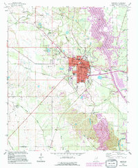
1992 Map of Aberdeen
USGS Topo · Published 1995About this map
The city of Aberdeen serves as a focal point for this survey, revealing the complex infrastructure of a Mississippi river town during the late 20th century. The landscape is defined by the massive engineering of the Tennessee-Tombigbee Waterway and the Aberdeen Lock and Dam, which redirected the original flow of the Tombigbee River. Extensive energy development is evident through the surrounding Treas Lake Gas Field and Aberdeen Gas Field, indicating the region's industrial reliance on subsurface resources alongside its maritime commerce.
Find a feature on this map
50 named features on this map. Tap any name to fly to it.
Don’t see what you’re looking for? This feature index may not catch every label — zoom into the map to look around manually.
Map Details
Editions of this 1992 Aberdeen Map
This is the sole edition of this map. No revisions or reprints were ever made.
Other maps of this area

1953 · West Point
USGS Topo · 1:250,000

1958 · West Point
USGS Topo · 1:250,000

1959 · West Point
USGS Topo · 1:62,500

1960 · Caledonia
USGS Topo · 1:62,500

1963 · West Point
USGS Topo · 1:250,000

1965 · Egypt
USGS Topo · 1:24,000

1966 · Aberdeen
USGS Topo · 1:24,000

1966 · Amory
USGS Topo · 1:24,000

1966 · Amory SW
USGS Topo · 1:24,000

1966 · Wren
USGS Topo · 1:24,000