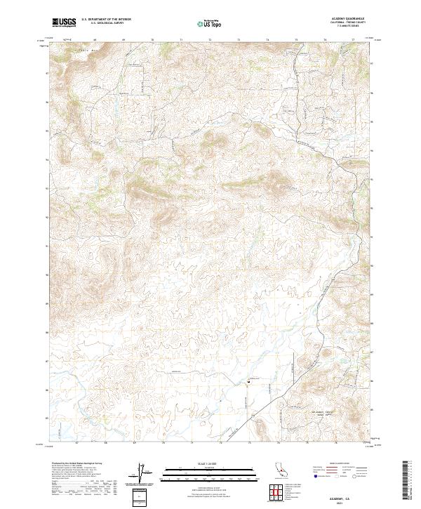
2021 Map of Academy
USGS Topo · Published 2021About this map
The Academy Cem sits at the heart of this landscape where the San Joaquin Valley begins its ascent into the Sierra foothills. This 2021 survey shows a complex network of seasonal drainages, including Dry Creek, Little Dry Cr, and Sales Cr, which define the undulating terrain south of the prominent Table Mtn. The infrastructure of the Central Valley is represented by the Friant-Kern Canal cutting through the southwestern corner, a vital component of the region's water management system. Residential growth and rural land divisions are evident near Mendocino, with numerous named roads such as Tollhouse Rd and Auberry Rd tracing historical routes into the higher country. The map provides a detailed view of modern rural life, showing individual building footprints and specialized tracks like Buggy Whip Ln and Knox Ln.
Find a feature on this map
53 named features on this map. Tap any name to fly to it.
Don’t see what you’re looking for? This feature index may not catch every label — zoom into the map to look around manually.
Map Details
Editions of this 2021 Academy Map
This is the sole edition of this map. No revisions or reprints were ever made.
Other maps of this area

1904 · Kaiser
USGS Topo · 1:125,000

1912 · Mariposa
USGS Topo · 1:125,000

1916 · Sulphur Springs
USGS Topo · 1:24,000

1919 · Sulphur Springs
USGS Topo · 1:31,680

1920 · Orangedale School
USGS Topo · 1:24,000

1922 · Round Mountain
USGS Topo · 1:31,680

1922 · Trimmer
USGS Topo · 1:96,000

1922 · Friant
USGS Topo · 1:31,680

1923 · Academy
USGS Topo · 1:31,680

1923 · Orangedale School
USGS Topo · 1:31,680