2022 Map of Achille
USGS Topo · Published 2022About this map
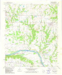
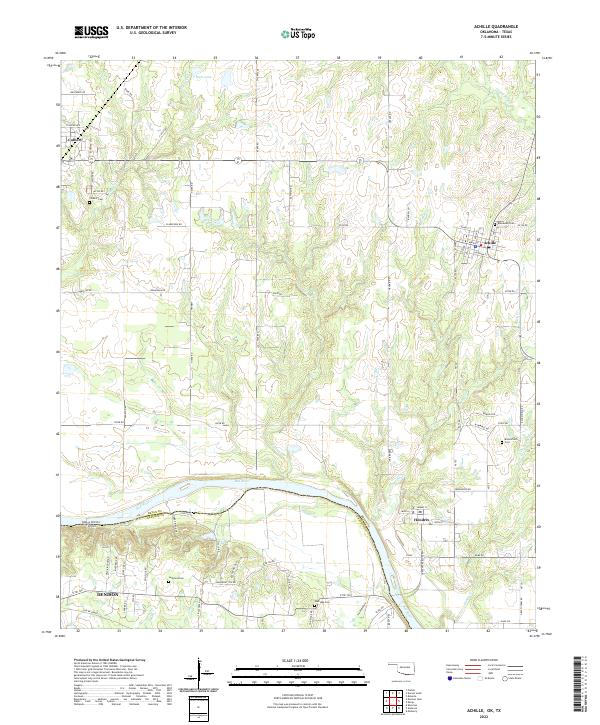
The Red River defines the southern boundary of this region, separating Bryan County, Oklahoma, from Grayson County, Texas. This riverine landscape is marked by the winding courses of Eastman Cr, Webb Cr, and Rock Cr, which feed into the main waterway. The settlement of Achille serves as a local hub, connected to neighboring Colbert and Hendrix through a network of section-line roads and specialized routes like Immigrant Trl Rd. The area is characterized by agricultural land interspersed with small bodies of water such as Ham Lake and McCarley Lake. Genealogists will find significant value in the distribution of family and community burial sites, including Colbert Cem, Rosewood Cem, and Bloomfield Cem. Evidence of past infrastructure is visible in the Old RR Grade south of Denison, illustrating the evolution of transport along the Oklahoma-Texas border.
Find a feature on this map
58 named features on this map. Tap any name to fly to it.
Don’t see what you’re looking for? This feature index may not catch every label — zoom into the map to look around manually.
Map Details
Editions of this 2022 Achille Map
This is the sole edition of this map. No revisions or reprints were ever made.