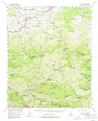
1959 Map of Acton
USGS Topo · Published 1977About this map
Acton sits at the northern edge of this high-altitude landscape where the Southern Pacific railroad cuts through Soledad Canyon. The terrain transitions from the rail-oriented settlements of Paris and Ravenna into the deep wilderness of the Angeles National Forest. Local education and social hubs are anchored at the Soledad-Agua Dulce Union Sch, while the interior peaks are dotted with working ranch sites like Blum Ranch and Niles Ranch.
Find a feature on this map
115 named features on this map. Tap any name to fly to it.
Don’t see what you’re looking for? This feature index may not catch every label — zoom into the map to look around manually.
Map Details
Editions of this 1959 Acton Map
3 editions found
Other maps of this area

1894 · Los Angeles
USGS Topo · 1:62,500

1894 · Pomona
USGS Topo · 1:62,500

1896 · Pasadena
USGS Topo · 1:62,500

1896 · Santa Monica
USGS Topo · 1:62,500

1897 · Pomona
USGS Topo · 1:62,500

1898 · Pomona
USGS Topo · 1:62,500

1898 · Santa Monica
USGS Topo · 1:62,500

1900 · Pasadena
USGS Topo · 1:62,500

1900 · Tujunga
USGS Topo · 1:62,500

1900 · Los Angeles
USGS Topo · 1:62,500