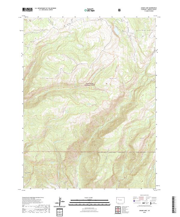
2022 Map of Adams Lake
USGS Topo · Published 2022About this map
White River National Forest defines the character of this high-elevation landscape, where the White River Plateau meets the prominent Clinetop Mesa. The terrain is defined by a series of high ridges and mountains, including Blair Mountain and Burnt Ridge, which serve as the headwaters for numerous alpine drainages. The map reveals a network of primitive routes and trails that navigate the steep elevation changes, providing access to secluded water sources like Adams Lake and Bugle Lake.
Find a feature on this map
41 named features on this map. Tap any name to fly to it.
Don’t see what you’re looking for? This feature index may not catch every label — zoom into the map to look around manually.
Map Details
Editions of this 2022 Adams Lake Map
This is the sole edition of this map. No revisions or reprints were ever made.
Other maps of this area

1906 · Grand Hogback
USGS Topo · 1:125,000

1910 · Grand Hogback
USGS Topo · 1:125,000

1927 · Glenwood Springs
USGS Topo · 1:125,000

1930 · Glenwood Springs
USGS Topo · 1:125,000

1957 · Leadville
USGS Topo · 1:250,000

1959 · Leadville
USGS Topo · 1:250,000

1960 · Leadville
USGS Topo · 1:250,000

1961 · Glenwood Springs
USGS Topo · 1:24,000

1962 · Leadville
USGS Topo · 1:250,000

1962 · New Castle
USGS Topo · 1:24,000