Old Maps of Garfield County, Colorado
Explore 535 old maps of Garfield County, spanning from 1885 to today. These high-resolution historic maps reveal how streets, neighborhoods, landmarks, and natural features evolved over time — perfect for genealogy, metal detecting, research, and local history exploration.
What you can do with these maps:
- See how Garfield County changed over time: Compare historical maps to modern-day views to trace roads, homesites, rail lines & more.
- View detailed metadata: Each map includes creators, publishers, year, scale, and archive source.
- Overlay maps with satellite & LiDAR: Visualize the past alongside modern tools to explore terrain & human change.
- Trusted historical sources: Maps sourced from the USGS, Library of Congress, and other archives.
- Access maps your way: View online, download high-res files, or order prints for personal or research use.
Start exploring old maps of Garfield County to uncover forgotten places, hidden landmarks, and the deep history beneath your feet.
Garfield County, CO maps
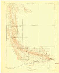
(535)- 1885 Map of East Tavaputs
 1885 East Tavaputs1885 Print · USGSEastern Utah in the mid-1880s was a landscape of massive plateaus and vital rail corridors. Researchers can trace the path of the Denver and Rio Grande Western through the Grand River Valley or locate water sources like Asphalt Creek and Bitter Water Creek.6 unique versions available
 - 1906 Map of Grand Hogback, 1959 Print
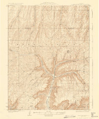
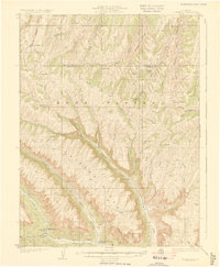
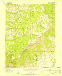
 1906 Grand Hogback1959 Print · USGSGarfield County at the turn of the century shows a frontier landscape defined by the rugged Grand Hogback and the vital Colorado River corridor. Researchers can trace early rail stops and rural outposts like Dinner Sta, Antlers, and the riverside town of Silt.
 - 1910 Map of Grand Hogback
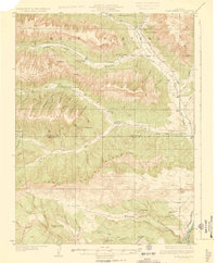
 1910 Grand Hogback1910 Print · USGSGarfield and Rio Blanco counties appear at the height of the early railroad era, defined by the towering spine of the Grand Hogback. Local historians can trace the early rail stops and river settlements like Rio Blanco, Antlers, and Dinner Sta.3 unique versions available
 - 1925 Map of Parachute Creek, 1965 Print
 1925 Parachute Creek1965 Print · USGSThe Roan Plateau in the mid-1920s was a center for early energy exploration and high-country ranching. Genealogists and historians can trace industrial outposts like Washington Shale Camp and local education at Granlee School across this mountain landscape.
 - 1927 Map of Parachute Creek
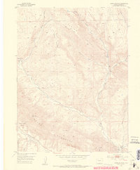
 1927 Parachute Creek1927 Print · USGSThe Book Plateau is shown here during the 1920s oil shale boom, prior to modern industrial development. Researchers can find early industrial outposts like Columbia Shale Camp, the Granlee School, and pioneer sites such as Summers Cabin.3 unique versions available
 - 1927 Map of Glenwood Springs, 1956 Print
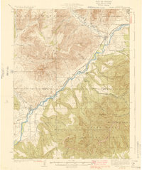
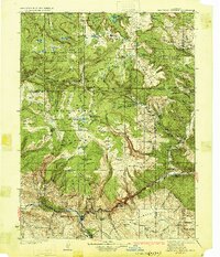
 1927 Glenwood Springs1956 Print · USGSGarfield County’s mountain interior comes to life in the 1920s, showing the high-country settlements and early forest service infrastructure across the Colorado River valley. Genealogists can trace family footprints at Sweetwater Lake Sch, the Shoshone Power Plant, and remote outposts like Hip Roof Cabin.3 unique versions available
 - 1929 Map of Grand Valley
 1929 Grand Valley1929 Print · USGSThe Colorado River corridor near the Garfield and Mesa County line reveals a landscape of early oil shale exploration and rail-side growth in the late 1920s. Genealogists can locate family landmarks like Cunningham Ranch and remote schools including Crawford Sch and Battlement Sch.3 unique versions available
 - 1929 Map of Highmore
 1929 Highmore1929 Print · USGSGarfield County’s high plateau country is captured here in the late twenties during a period of mountain ranching and early energy exploration. Researchers can find old homesteads like Denton Cabin, the Good Hope Shale Camp, and the original Highmore PO site.3 unique versions available
 - 1929 Map of Roan Creek
 1929 Roan Creek1929 Print · USGSThe Colorado oil shale country is captured here in the late 1920s as industry and ranching met in the canyons. Researchers can locate remote schools like Dry Fork Sch, the INDEX SHALE PLANT, and early family outposts including Wilcoxson Ranch.3 unique versions available
 - 1930 Map of Glenwood Springs
 1930 Glenwood Springs1930 Print · USGSGlenwood Springs and the Colorado River corridor are captured here during the late prohibition era, showing the region's transition into a center for power and rail transport. Researchers can trace the Denver and Rio Grande Western Railroad to Dotsero or find remote outposts like Hip Roof Cabin and Transfer Springs Ranger Sta.4 unique versions available
 - 1952 Map of Rio Blanco, 1954 Print
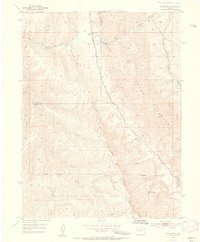 1952 Rio Blanco1954 Print · USGSDeep in the Western Slope during the early fifties, this area centers on the small settlement of Rio Blanco. Local historians can trace the Rio Blanco School, the Rio Blanco Mine, and the original path of the Government Road.5 unique versions available
 - 1952 Map of Anvil Points, 1954 Print
 1952 Anvil Points1954 Print · USGSGarfield County is captured during the height of mid-century energy experimentation within the Naval Oil Shale Reserve. Local researchers can trace early industrial footprints like the Anvil Points Oil Shale Mines and the Bureau of Mines Oil Shale Experiment Station.10 unique versions available
 - 1952 Map of Horse Mountain, 1954 Print
 1952 Horse Mountain1954 Print · USGSGarfield County is captured in the early fifties during a period of transition for its mountain mining and ranching communities. Researchers can locate the Upper Rifle Creek School, several Coal Mines, and the boundaries of the Naval Oil Shale Reserve.9 unique versions available
 - 1952 Map of Rifle, 1954 Print
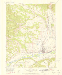 1952 Rifle1954 Print · USGSThe Colorado River valley at Rifle comes alive in the early fifties, showing a landscape defined by strategic oil shale reserves and riverside industry. Genealogists and researchers can trace local landmarks like the Rifle Cem, the Vanadium Mill, and the Denver and Rio Grande Western rail lines.7 unique versions available
 - 1954 Map of Craig, 1973 Print
 1954 Craig1973 Print · USGSNorthwest Colorado and the high mountain parks are captured in the mid-fifties, showing the region's ranching, mining, and timber centers. Genealogists and historians can trace rail corridors like the Denver and Rio Grande Western and old towns such as Axial, Milner, and Coalmont.3 unique versions available
 - 1956 Map of Grand Junction, 1973 Print
 1956 Grand Junction1973 Print · USGSThe Grand Valley and its surrounding high plateaus are captured here in the mid-twentieth century as the region's ranching and rail heritage remained central. Researchers can trace the path of the Denver & Rio Grande Western RR through Grand Junction or locate remote outposts like Dragon and Atchee.2 unique versions available
 - 1957 Map of Craig
 1957 Craig1957 Print · USGSNorthwest Colorado in the mid-fifties is a landscape of mountain ranching and rail-dependent river towns. Researchers can trace historic coal mining at the Sudduth Mine, follow the Denver and Rio Grande Western tracks, and locate vanished settlements like Pearl.
 - 1957 Map of Leadville, 1978 Print
 1957 Leadville1978 Print · USGSHigh-country mining and rail transport define the central Colorado Rockies during the mid-to-late twentieth century. Researchers can trace the industrial footprints of Gilman and Climax, find small rail stops like Malta, and follow the Denver and Rio Grande Western RR.2 unique versions available
 - 1958 Map of Craig
 1958 Craig1958 Print · USGSNorthwest Colorado and the High Rockies are captured here in the mid-fifties, showing a landscape of burgeoning water projects and mountain ranching. Genealogists and historians can trace old homesteads and mountain outposts from Grand Lake to Meeker, alongside industrial landmarks like Uranium Mines and the Denver and Rio Grande Western railroad.
 - 1959 Map of Grand Junction
 1959 Grand Junction1959 Print · USGSThe Grand Valley and the high plateaus of the Colorado-Utah border come into focus in the late fifties as irrigation and rail lines define the landscape. Local historians can trace several industrial outposts labeled as abandoned, including Watson and Dragon, alongside the Denver and Rio Grande Western RR.
 - 1959 Map of Leadville
 1959 Leadville1959 Print · USGSThe Colorado high country in the late fifties is a landscape of mining history and military training, from the streets of Leadville to the Camp Hale grounds. Genealogists and historians can trace the Denver and Rio Grande Western RR alongside now-deserted sites like Ashcroft and Independence.
 - 1960 Map of Leadville
 1960 Leadville1960 Print · USGSThe Colorado high country in the mid-fifties comes alive through its mining camps, river valleys, and rail lines. Trace the industrial legacy of the Climax Molybdenum Mine and explore the alpine reaches of the Camp Hale Military Reservation.2 unique versions available
 - 1960 Map of Craig
 1960 Craig1960 Print · USGSNorthwest Colorado in the 1950s is a landscape of mountain summits and industrial growth at the headwaters of the West. Genealogists and historians can trace rail-town development along the Denver and Salt Lake line, while locating Uranium Mines and settlements like Craig, Meeker, and Steamboat Springs.
 - 1960 Map of Grand Junction
 1960 Grand Junction1960 Print · USGSThe Grand Junction area at the dawn of the 1960s shows a landscape of river-valley agriculture and high-plateau extraction. Researchers can trace the path of the dismantled railroad and find vanished sites like Watson and Sego.2 unique versions available
 - 1960 Map of North Mamm Peak, 1964 Print
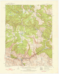
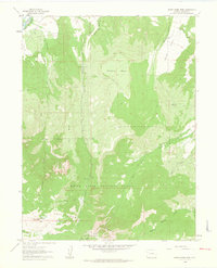 1960 North Mamm Peak1964 Print · USGSGarfield County’s high plateaus and early energy exploration are documented here in the early 1960s. Trace the network of pack trails through White River National Forest to landmarks like North Mamm Peak, Flatiron Mesa, and Tepee Park.4 unique versions available
Showing maps 1-25 of 535
Top cities of Garfield County
- Glenwood Springs historical maps
- Rifle historical maps
- Carbondale historical maps
- New Castle historical maps
- Silt historical maps
- Parachute historical maps
Frequently asked questions
- What are the different types of historical maps available for Garfield County?
- What is the oldest map of Garfield County?
- Where can I purchase historical maps of Garfield County for my home or office?
- Where can I download high-res historical maps of Garfield County?
- Are there historical topographic maps available for Garfield County?
- Is there historical aerial imagery available for Garfield County?
- Where are historical maps of Garfield County sourced from?