1960s Maps of Garfield County, Colorado
Explore 65 historic maps of Garfield County from the 1960s. These maps offer a rare glimpse into what life looked like during the 1960s — showing old roads, neighborhoods, homes, and landmarks that have changed or disappeared over time.
Whether you're researching your family's past, planning a metal detecting trip, or studying how Garfield County's landscape evolved across the 1960s, these high-resolution maps are a powerful tool for exploring the history of this region.
- Focus on a specific era: All maps on this page are from the 1960s, giving you a focused view of this time period.
- See what’s changed: Compare century-old streets, trails, and buildings to today's modern landscape using overlays and satellite layers.
- Research with precision: Use these maps for genealogy, historical research, land use analysis, or educational projects.
- View, download, or print: Maps are fully viewable online in high resolution, and can be downloaded or printed for your own records.
Start exploring Garfield County's history through authentic maps from the 1960s. This is your window into the past.
Garfield County, CO maps
(65)- 1960 Map of Leadville
 1960 Leadville1960 Print · USGSThe Colorado high country in the mid-fifties comes alive through its mining camps, river valleys, and rail lines. Trace the industrial legacy of the Climax Molybdenum Mine and explore the alpine reaches of the Camp Hale Military Reservation.2 unique versions available
 - 1960 Map of Craig
 1960 Craig1960 Print · USGSNorthwest Colorado in the 1950s is a landscape of mountain summits and industrial growth at the headwaters of the West. Genealogists and historians can trace rail-town development along the Denver and Salt Lake line, while locating Uranium Mines and settlements like Craig, Meeker, and Steamboat Springs.
 - 1960 Map of Grand Junction
 1960 Grand Junction1960 Print · USGSThe Grand Junction area at the dawn of the 1960s shows a landscape of river-valley agriculture and high-plateau extraction. Researchers can trace the path of the dismantled railroad and find vanished sites like Watson and Sego.2 unique versions available
 - 1960 Map of North Mamm Peak, 1964 Print
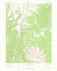
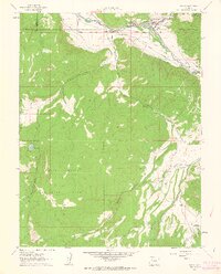
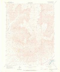
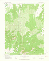 1960 North Mamm Peak1964 Print · USGSGarfield County’s high plateaus and early energy exploration are documented here in the early 1960s. Trace the network of pack trails through White River National Forest to landmarks like North Mamm Peak, Flatiron Mesa, and Tepee Park.4 unique versions available
 - 1960 Map of Hawxhurst Creek, 1964 Print
 1960 Hawxhurst Creek1964 Print · USGSThe Colorado high country along the Garfield and Mesa county line is shown here in the early sixties as a landscape of remote cattle camps and water management. Researchers can trace historic grazing sites like Kennon Cow Camp and family landmarks near Clover Cem.4 unique versions available
 - 1960 Map of South Mamm Peak, 1964 Print
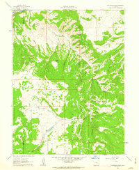
 1960 South Mamm Peak1964 Print · USGSHigh mesa country on the Garfield and Mesa County line is documented here in the early sixties. Genealogists and local historians can locate the Heiberger (Site), trace the Battlement Trail, and find the old Clover Sch along Plateau Creek.4 unique versions available
 - 1960 Map of Rulison, 1964 Print
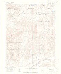
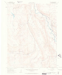
 1960 Rulison1964 Print · USGSGarfield County's river-and-rail corridor is captured here in the early 1960s as energy exploration began to shape the land. Researchers can trace the Denver and Rio Grande Western River railroad, locate the Rulison settlement, and find historic paths like the Battlement Trail.5 unique versions available
 - 1961 Map of Mount Sopris, 1963 Print
 1961 Mount Sopris1963 Print · USGSMount Sopris and the Crystal River valley are shown here in the early sixties as a landscape of alpine peaks and early transit corridors. Researchers can trace the Old Railroad Grade or locate high-altitude landmarks like Thomas Lakes and St John Res.5 unique versions available
 - 1961 Map of Cattle Creek, 1963 Print
 1961 Cattle Creek1963 Print · USGSThe Cattle Creek corridor was a hub of mountain industry and rail transport in the early sixties. Genealogists and historians can trace the Denver and Rio Grande Western line, the Black Diamond Mine, and local landmarks like Crystal River Ranch.7 unique versions available
 - 1961 Map of Carbondale, 1963 Print
 1961 Carbondale1963 Print · USGSCarbondale and the Roaring Fork Valley are documented here in the early sixties as a thriving agricultural and rail-oriented community. Researchers can trace historic irrigation lines, early settlements like Sutank, and local landmarks including Fisher Cem and Rocky Mountain Sch.8 unique versions available
 - 1961 Map of Leon, 1963 Print
 1961 Leon1963 Print · USGSThe Roaring Fork Valley in the early 1960s shows a landscape of mountain ranching and early development. Follow the tracks of the Denver and Rio Grande Western near El Jebel or trace the irrigation lines of the Home Supply Ditch.4 unique versions available
 - 1961 Map of Basalt, 1963 Print
 1961 Basalt1963 Print · USGSThe Roaring Fork Valley in the early sixties was a landscape of rail transit and mountain agriculture. Trace the course of the Denver and Rio Grande Western Railroad past Emma and Wingo or locate the St Benedict Monastery near Capitol Creek.6 unique versions available
 - 1961 Map of Cottonwood Pass, 1963 Print
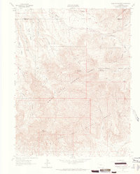
 1961 Cottonwood Pass1963 Print · USGSThis Colorado high-country landscape in the early sixties centers on the Cottonwood Divide and the northern reaches of the White River National Forest. Researchers can trace the winding Cottonwood Trail and identify local landmarks like The Eagle Nest and Von Springs Reservoir.7 unique versions available
 - 1961 Map of Shoshone, 1963 Print
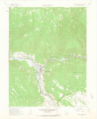
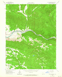
 1961 Shoshone1963 Print · USGSGarfield County's river-and-rail corridor is documented here in the early sixties as it winds through the canyon floor. Researchers can trace the Hopkins Homestead, the Shoshone Dam, and the winding tracks of the Denver and Rio Grande Western railroad.4 unique versions available
 - 1961 Map of Glenwood Springs, 1963 Print
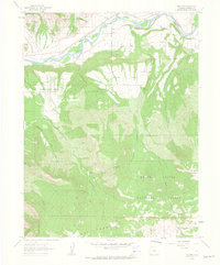
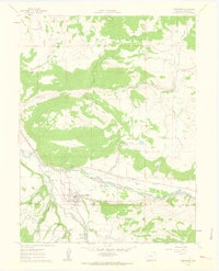
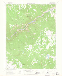
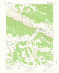
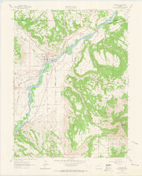
 1961 Glenwood Springs1963 Print · USGSGlenwood Springs at the start of the 1960s is shown as a vital mountain crossroads where the Colorado and Roaring Fork rivers meet. Researchers can trace the town's layout from Rosebud Cemetery to the Coke Ovens at Cardiff, alongside the vital D & R G W rail lines.6 unique versions available
 - 1962 Map of Leadville
 1962 Leadville1962 Print · USGSThe Colorado high country in the early sixties was a rugged landscape of mining camps, military training grounds, and emerging ski towns. Researchers can trace the legacy of Camp Hale, locate the Molybdenum mine near Leadville, and follow the Denver and Rio Grande Western RR through the canyons.
 - 1962 Map of Grand Junction
 1962 Grand Junction1962 Print · USGSThe Western Slope of the early sixties comes into focus here, showing the irrigation-driven growth of the valley and the surrounding high desert. Trace the path of the Denver and Rio Grande Western RR or locate old outposts like Atchee and Dragon.
 - 1962 Map of Craig
 1962 Craig1962 Print · USGSNorthwest Colorado in the early sixties is a land of high-elevation ranching and remote river valleys. Genealogists and historians can trace the Denver and Rio Grande Western rail lines and locate early settlements like Hahns Peak, Meeker, and Juniper Springs.
 - 1962 Map of New Castle, 1963 Print
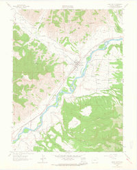
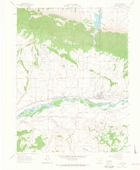
 1962 New Castle1963 Print · USGSNew Castle and the Colorado River valley are captured in the early sixties as the railroad and irrigation networks defined local life. Genealogists and historians can trace family-named water rights and landmarks like High Land Cem, Burning Mountain, and the Denver and Rio Grande Western rail line.7 unique versions available
 - 1962 Map of Grand Valley, 1964 Print
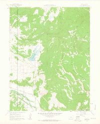
 1962 Grand Valley1964 Print · USGSGarfield County's river-and-rail corridor is captured here in the early sixties, centered on the settlement of Grand Valley. Genealogists and historians can trace family roots at the Russey-Hurlburth Cem and locate landmarks like Battlement Sch.3 unique versions available
 - 1962 Map of Storm King Mountain, 1964 Print
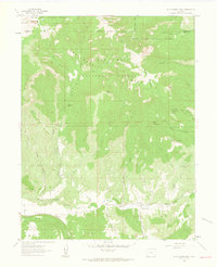
 1962 Storm King Mountain1964 Print · USGSGarfield County in the early 1960s is defined by the rail and water corridors cutting through the high country. Trace the path of the Denver and Rio Grande Western past Chacra or locate the Canyon Creek Sch and Okanela Lodge.4 unique versions available
 - 1962 Map of Housetop Mountain, 1964 Print
 1962 Housetop Mountain1964 Print · USGSThe high plateau country of the Mesa and Garfield county border is captured here in the early sixties. Naturalists and researchers can trace the drainages of Wallace Creek and locate remote landmarks like Horsethief Gulch and Castle Peak.4 unique versions available
 - 1962 Map of Red Pinnacle, 1964 Print
 1962 Red Pinnacle1964 Print · USGSGarfield County's high-plateau country comes into focus in the early sixties as it transitions from the high peaks toward the Colorado River. Researchers can trace the Denver and Rio Grande Western rail line and find remote Cabins near Mount Logan.4 unique versions available
 - 1962 Map of De Beque, 1964 Print
 1962 De Beque1964 Print · USGSThe Colorado River valley and the town of De Beque come into sharp focus in the early 1960s as a vital rail and ranching corridor. Trace the path of the Denver and Rio Grande Western railroad and locate family-named landmarks like Samson Mesa and Ashmead Draw.4 unique versions available
 - 1962 Map of Silt, 1964 Print
 1962 Silt1964 Print · USGSThe Colorado River valley comes into focus in the early sixties as the railroad and irrigation networks define the landscape near Silt. Trace the historic Denver and Rio Grande Western tracks, find the old Drive-in Theater, and follow the complex Last Chance Ditch.7 unique versions available
Showing maps 1-25 of 65
Top cities of Garfield County
- Glenwood Springs historical maps
- Rifle historical maps
- Carbondale historical maps
- New Castle historical maps
- Silt historical maps
- Parachute historical maps
Frequently asked questions
- What are the different types of historical maps available for Garfield County?
- What is the oldest map of Garfield County?
- Where can I purchase historical maps of Garfield County for my home or office?
- Where can I download high-res historical maps of Garfield County?
- Are there historical topographic maps available for Garfield County?
- Is there historical aerial imagery available for Garfield County?
- Where are historical maps of Garfield County sourced from?