1970s Maps of Garfield County, Colorado
Explore 26 historic maps of Garfield County from the 1970s. These maps offer a rare glimpse into what life looked like during the 1970s — showing old roads, neighborhoods, homes, and landmarks that have changed or disappeared over time.
Whether you're researching your family's past, planning a metal detecting trip, or studying how Garfield County's landscape evolved across the 1970s, these high-resolution maps are a powerful tool for exploring the history of this region.
- Focus on a specific era: All maps on this page are from the 1970s, giving you a focused view of this time period.
- See what’s changed: Compare century-old streets, trails, and buildings to today's modern landscape using overlays and satellite layers.
- Research with precision: Use these maps for genealogy, historical research, land use analysis, or educational projects.
- View, download, or print: Maps are fully viewable online in high resolution, and can be downloaded or printed for your own records.
Start exploring Garfield County's history through authentic maps from the 1970s. This is your window into the past.
Garfield County, CO maps
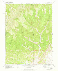
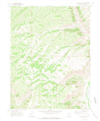
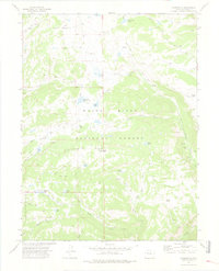
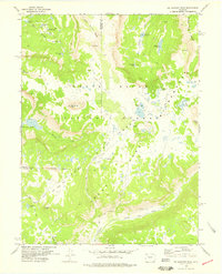
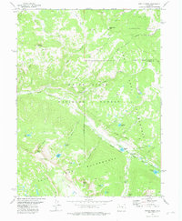
(26)- 1970 Map of Bar X Wash, 1973 Print
 1970 Bar X Wash1973 Print · USGSThe high-desert borderlands of Grand County and Mesa County are captured here in 1970 during an era of intensive energy exploration. Researchers can trace the network of the Stateline Gas Field and locate industrial landmarks like numerous gas wells and the steep slopes of the Book Cliffs.2 unique versions available
 - 1970 Map of Jim Canyon, 1973 Print
 1970 Jim Canyon1973 Print · USGSThe Utah-Colorado borderlands come alive in this early 1970s survey of the high desert and energy country. Local historians and researchers can trace the development of the San Arroyo Gas Field and remote routes like the Jeep Trail through Jim Canyon.2 unique versions available
 - 1971 Map of Mount Blaine, 1973 Print
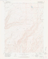
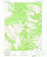
 1971 Mount Blaine1973 Print · USGSGarfield County's high-elevation terrain is captured here in the early seventies, showing a landscape defined by ridges and resource exploration. Trace the paths of vintage pack trails and jeep trails near Mount Blaine and Deer Park.3 unique versions available
 - 1971 Map of McCarthy Gulch, 1974 Print
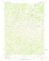
 1971 McCarthy Gulch1974 Print · USGSThe high plateau country of the Rio Blanco and Garfield county line is shown here in the early seventies during a period of active energy exploration. Researchers can find numerous prospects and jeep trails winding through McCarthy Gulch and the Naval Oil Shale Reserve.2 unique versions available
 - 1971 Map of Cutoff Gulch, 1974 Print
 1971 Cutoff Gulch1974 Print · USGSGarfield and Rio Blanco counties meet in this 1970s survey of the high plateau country north of the Colorado River. Researchers can trace the network of ranch roads and mining claims along Stewart Gulch, Cutoff Gulch, and the remote West Fork Parachute Creek.3 unique versions available
 - 1971 Map of Forked Gulch, 1974 Print
 1971 Forked Gulch1974 Print · USGSGarfield County’s high-country energy frontier is captured here in the early 1970s, showcasing the intersection of industrial extraction and rugged Colorado terrain. Researchers can trace early oil infrastructure at the Oil Shale Plant and find family-named landmarks like Lindauer Point and Schoolhouse Point.
 - 1971 Map of Desert Gulch, 1974 Print
 1971 Desert Gulch1974 Print · USGSGarfield County’s high country in the early seventies was a land of steep ridges and remote drainages used primarily for ranching and resource exploration. You can trace early routes like the Pack Trail and Jeep Trail as they connect isolated landmarks such as the Corral and several scattered Prospects.2 unique versions available
 - 1971 Map of Figure Four Spring, 1974 Print
 1971 Figure Four Spring1974 Print · USGSRio Blanco and Garfield Counties are captured in the early seventies, showing a landscape defined by resource exploration and remote waterways. Trace historic Jeep Trails past Eureka or locate the numerous Prospect sites and Figure Four Spring.2 unique versions available
 - 1971 Map of Circle Dot Gulch, 1974 Print
 1971 Circle Dot Gulch1974 Print · USGSGarfield County's high-country drainages are captured here in the early seventies as a network of trails and irrigation ditches. Researchers can trace historic water management and ranching features like Granlee Ditch, Circle Dot Gulch, and the remote Jangle.3 unique versions available
 - 1971 Map of Bull Fork, 1974 Print
 1971 Bull Fork1974 Print · USGSThe high plateau country along the Garfield and Rio Blanco county line is captured here in the early seventies during a period of active exploration. Trace historical resource markers like Drill Holes and Prospects among the rugged drainages of Bull Fork and Whiskey Gulch.3 unique versions available
 - 1974 Map of Dotsero, 1977 Print
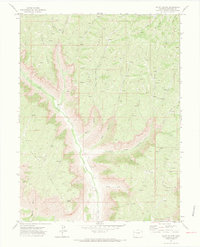
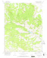
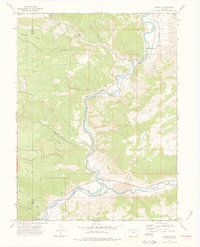 1974 Dotsero1977 Print · USGSThe confluence of the Colorado and Eagle Rivers is captured in the mid-seventies, showing the vital rail corridor through the canyons. Researchers can trace the path of the Denver and Rio Grande Western and locate landmarks like the Dotsero Crater and Hells Gate.3 unique versions available
 - 1974 Map of Broken Rib Creek, 1977 Print
 1974 Broken Rib Creek1977 Print · USGSHigh in the Colorado Rockies during the mid-seventies, this survey shows the rugged terrain of the White River National Forest. Researchers can locate historic backcountry landmarks like Indian Cave and follow the route of Coffee Pot Road to its namesake Campground.3 unique versions available
 - 1974 Map of Carbonate, 1978 Print
 1974 Carbonate1978 Print · USGSThe high timberline of Garfield County is captured here in the mid-1970s, showing a landscape defined by forest service trails and remote camps. Researchers can trace historic access routes to Carbonate, Grizzly Cow Camp, and the many alpine waters like White Owl Lake.3 unique versions available
 - 1974 Map of Adams Lake, 1978 Print
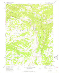
 1974 Adams Lake1978 Print · USGSGarfield County’s high plateau country is captured here during the mid-seventies, showing the complex web of trails used to navigate this corner of the White River National Forest. Researchers can trace old routes across Clinetop Mesa and locate remote landmarks like Adams Lake and Boiler Spring.3 unique versions available
 - 1977 Map of Sweetwater Lake, 1978 Print
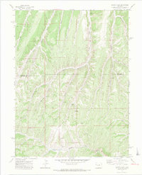
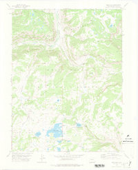
 1977 Sweetwater Lake1978 Print · USGSThe high plateaus of Garfield County are shown here in the late seventies as the wilderness era shaped the landscape. Genealogists and researchers can trace ranching and forest history at Hilltop Ranch, Sweetwater Guard Sta, and Johnny Meyers Lake.2 unique versions available
 - 1977 Map of Trappers Lake, 1978 Print
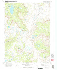 1977 Trappers Lake1978 Print · USGSIn the late 1970s, this high-country wilderness showcases the dramatic basalt cliffs of the Chinese Wall and the pristine waters of Trappers Lake. Researchers can trace old pack routes through the Flat Tops Wilderness and locate remote landmarks like Shingle Peak and Wall Lake.3 unique versions available
 - 1977 Map of Orno Peak, 1978 Print
 1977 Orno Peak1978 Print · USGSHigh in the Colorado Rockies during the late seventies, this area shows the essential water infrastructure of the Flat Tops region. Trace historic wilderness routes like the Ute (Pack) Trail and locate remote landmarks such as Orno Peak and Maggies Nipple.3 unique versions available
 - 1977 Map of Big Marvine Peak, 1978 Print
 1977 Big Marvine Peak1978 Print · USGSHigh plateaus and alpine lakes define this Garfield and Rio Blanco County border area in the mid-seventies. Trace a network of pack trails through the Flat Tops Wilderness past Big Marvine Peak, Marvine Lakes, and Big Fish Lake.3 unique versions available
 - 1977 Map of Deep Lake, 1978 Print
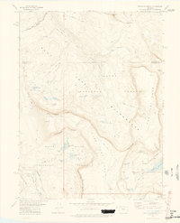
 1977 Deep Lake1978 Print · USGSThe White River Plateau in the late 1970s is shown as a primitive landscape of alpine lakes and wilderness trails. You can trace early routes like the Wagonwheel Trail and Ute Trail or locate remote camps near Deep Lake and Bison Lake.2 unique versions available
 - 1977 Map of Oyster Lake, 1978 Print
 1977 Oyster Lake1978 Print · USGSThe high plateau of Rio Blanco County in the 1970s is shown in detail, focusing on the remote wilderness and trail networks. Researchers can trace the Oyster Lake Trail (Pack) through the Flat Tops to remote sites like Papoose Lake and Camel Peak.4 unique versions available
 - 1977 Map of Dome Peak, 1978 Print
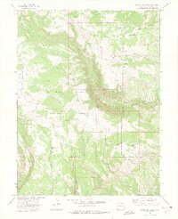
 1977 Dome Peak1978 Print · USGSThe high alpine plateaus of Northwest Colorado are captured here in the late seventies, detailing the remote terrain where Garfield and Eagle counties meet. Researchers can trace the high-country water systems of Lion Basin Ditch and historical paths like the Ute Trail across the Derby Mesa.
 - 1977 Map of Devils Causeway, 1978 Print
 1977 Devils Causeway1978 Print · USGSThe high alpine plateaus of Colorado's western slope are shown here in the late seventies just after the wilderness designation. You can trace remote backcountry routes like the Blue Mountain Trail and identify high-country features such as Pyramid Peak and the Chinese Wall.4 unique versions available
 - 1977 Map of Blair Mountain, 1978 Print
 1977 Blair Mountain1978 Print · USGSGarfield and Rio Blanco counties are shown here in the late seventies as a preserved alpine wilderness defined by the high plateaus of the White River National Forest. Trace historic travel routes like the Ute Trail and Pack Trails past Blair Lake, South Fork Falls, and Fowler Peak.2 unique versions available
 - 1977 Map of Ripple Creek, 1978 Print
 1977 Ripple Creek1978 Print · USGSThe high alpine plateaus of Rio Blanco and Garfield Counties are shown here in the late seventies, a landscape defined by wilderness and national forest. Trace the network of pack trails connecting Mirror Lake, Ripple Creek Pass, and the waters of Bessies Falls.
 - 1977 Map of Sugarloaf Mountain, 1981 Print
 1977 Sugarloaf Mountain1981 Print · USGSThe high wilderness of Eagle and Garfield counties is captured here in the late seventies, showing a landscape defined by forest service lands and wildlife preserves. Researchers can trace the rugged Denver and Rio Grande Western rail line and locate the Riland Community Center or the Natural Bridge.2 unique versions available
Showing maps 1-25 of 26
Top cities of Garfield County
- Glenwood Springs historical maps
- Rifle historical maps
- Carbondale historical maps
- New Castle historical maps
- Silt historical maps
- Parachute historical maps
Frequently asked questions
- What are the different types of historical maps available for Garfield County?
- What is the oldest map of Garfield County?
- Where can I purchase historical maps of Garfield County for my home or office?
- Where can I download high-res historical maps of Garfield County?
- Are there historical topographic maps available for Garfield County?
- Is there historical aerial imagery available for Garfield County?
- Where are historical maps of Garfield County sourced from?