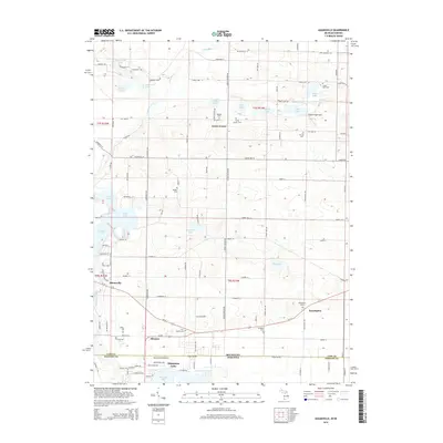
2014 Map of Adamsville
USGS Topo · Published 2014About this map
Calvin Center and the surrounding township terrain in Cass County define this 2014 survey, which covers a transition from the rolling lakelands of Michigan into the northern edge of Indiana. The landscape is dotted with numerous small water bodies, including Chain Lake, Round Lake, and Curtis Lake, suggesting the glacial geology of the region. This area maintains a quiet, rural character marked by historical crossroads and several cemeteries that anchor the local genealogy, such as Bethel Cem and Shaffer Cem.
Find a feature on this map
73 named features on this map. Tap any name to fly to it.
Don’t see what you’re looking for? This feature index may not catch every label — zoom into the map to look around manually.
Map Details
Editions of this 2014 Adamsville Map
This is the sole edition of this map. No revisions or reprints were ever made.
Other maps of this area

1945 · Cassopolis
USGS Topo · 1:62,500

1947 · Cassopolis
USGS Topo · 1:62,500

1948 · Vandalia
USGS Topo · 1:62,500

1949 · Vandalia
USGS Topo · 1:62,500

1953 · Fort Wayne
USGS Topo · 1:250,000

1953 · Chicago
USGS Topo · 1:250,000

1956 · Fort Wayne
USGS Topo · 1:250,000

1957 · Chicago
USGS Topo · 1:250,000

1958 · Osceola
USGS Topo · 1:24,000
1961 · Bristol
USGS Topo · 1:24,000