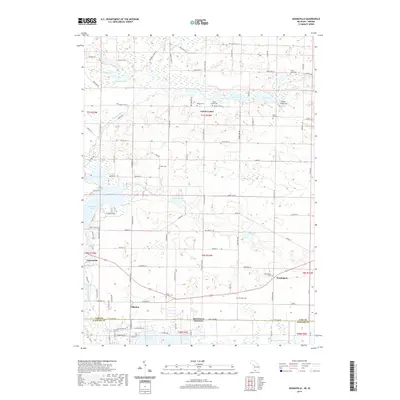
2019 Map of Adamsville
USGS Topo · Published 2019About this map
Calvin Center and the surrounding rural townships of Cass County appear in detail on this survey, highlighting a landscape defined by an intricate network of glacial lakes and historic burying grounds. The southern edge of the sheet follows the Michigan and Indiana border, where the community of Allenton and the northern tip of Simonton Lake cross the state line. Genealogists will find a wealth of local history preserved in the numerous cemeteries scattered across the township, including Bethel Cem, Mount Zion Cem, and the isolated Shaffer Cem further west.
Find a feature on this map
101 named features on this map. Tap any name to fly to it.
Don’t see what you’re looking for? This feature index may not catch every label — zoom into the map to look around manually.
Map Details
Editions of this 2019 Adamsville Map
This is the sole edition of this map. No revisions or reprints were ever made.
Other maps of this area

1945 · Cassopolis
USGS Topo · 1:62,500

1947 · Cassopolis
USGS Topo · 1:62,500

1948 · Vandalia
USGS Topo · 1:62,500

1949 · Vandalia
USGS Topo · 1:62,500

1953 · Fort Wayne
USGS Topo · 1:250,000

1953 · Chicago
USGS Topo · 1:250,000

1956 · Fort Wayne
USGS Topo · 1:250,000

1957 · Chicago
USGS Topo · 1:250,000

1958 · Osceola
USGS Topo · 1:24,000
1961 · Bristol
USGS Topo · 1:24,000