2024 Map of Addieville
USGS Topo · Published 2024About this map
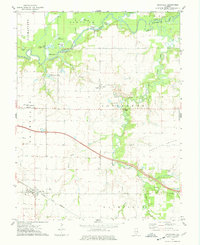
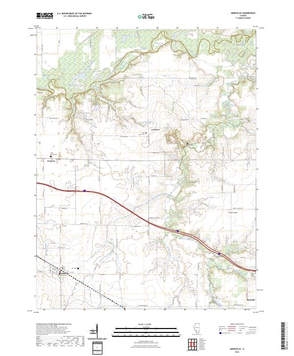
Kaskaskia River and Crooked Creek define the low-lying northern border of this Illinois landscape, where a dense network of lakes like Big Flat Lake, Turkey Lake, and Wildcat Lake suggests a seasonal floodplain. In the southern half, the settlement of Addieville is centered at the junction of N Center St and E 1st St, with the nearby Zion Cem and Old Zion Cem providing specific points of interest for genealogical research. The region is characterized by a grid of rural roads named after wildlife, including Bobwhite Rd, Oriole Rd, and Chickadee Rd. Further north, the small community of Covington sits near the Saint Lukes Cem, while the crossroad of Frogtown marks a transition toward the river bottomlands. This contemporary survey details the persistent rural character of Washington County, showing how modern infrastructure follows the early paths of settlements like North Prairie.
Find a feature on this map
67 named features on this map. Tap any name to fly to it.
Don’t see what you’re looking for? This feature index may not catch every label — zoom into the map to look around manually.
Map Details
Editions of this 2024 Addieville Map
This is the sole edition of this map. No revisions or reprints were ever made.