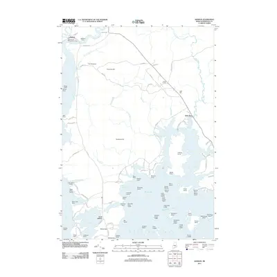
2011 Map of Addison
USGS Topo · Published 2011About this map
Addison and the village of South Addison anchor this coastal Maine landscape, situated where the Pleasant River and Indian River meet the Atlantic. The intricate shoreline is defined by an array of islands and inlets, including the large Crowley Island and the waters of Wohoa Bay and Moosabec Reach. Inland, the terrain rises toward The Highlands and Hardwood Hill, while small settlements like Tracy Corners and Bryant Corners dot the intersections of rural routes such as Indian River Rd.
Find a feature on this map
104 named features on this map. Tap any name to fly to it.
Don’t see what you’re looking for? This feature index may not catch every label — zoom into the map to look around manually.
Map Details
Editions of this 2011 Addison Map
This is the sole edition of this map. No revisions or reprints were ever made.
Other maps of this area

1902 · Cherryfield
USGS Topo · 1:62,500

1904 · Cherryfield
USGS Topo · 1:62,500

1904 · Petit Manan
USGS Topo · 1:62,500

1921 · Great Wass Island
USGS Topo · 1:62,500

1921 · Columbia Falls
USGS Topo · 1:62,500

1921 · Columbia Falls
USGS Topo · 1:62,500

1941 · Columbia Falls
USGS Topo · 1:62,500

1942 · Cherryfield
USGS Topo · 1:62,500

1942 · Columbia Falls
USGS Topo · 1:62,500

1948 · Jonesport
USGS Topo · 1:24,000