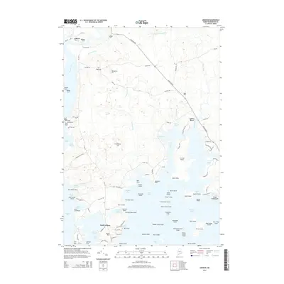
2014 Map of Addison
USGS Topo · Published 2014About this map
The tidal rivers and labyrinthine coastal archipelago of Washington County define this landscape, where Addison and Addison Point overlook the lower reaches of the Pleasant River. This maritime environment is characterized by significant topographic features such as The Highlands and Porcupine Hill, which rise above the surrounding marshes and brooks. Settlement patterns follow the winding coastal roads, notably Indian River Rd, which connects the northern town centers to the smaller fishing outposts like South Addison and the rocky protrusions of Cape Split.
Find a feature on this map
116 named features on this map. Tap any name to fly to it.
Don’t see what you’re looking for? This feature index may not catch every label — zoom into the map to look around manually.
Map Details
Editions of this 2014 Addison Map
This is the sole edition of this map. No revisions or reprints were ever made.
Other maps of this area

1902 · Cherryfield
USGS Topo · 1:62,500

1904 · Cherryfield
USGS Topo · 1:62,500

1904 · Petit Manan
USGS Topo · 1:62,500

1921 · Great Wass Island
USGS Topo · 1:62,500

1921 · Columbia Falls
USGS Topo · 1:62,500

1921 · Columbia Falls
USGS Topo · 1:62,500

1941 · Columbia Falls
USGS Topo · 1:62,500

1942 · Cherryfield
USGS Topo · 1:62,500

1942 · Columbia Falls
USGS Topo · 1:62,500

1948 · Jonesport
USGS Topo · 1:24,000