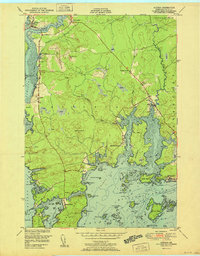
1951 Map of Addison
USGS Topo · Published 1951About this map
The coastal village of South Addison and the neighboring settlements of Addison and West Jonesport define this 1951 survey of the Maine coastline. This coastal landscape is dominated by complex tidal inlets and numerous islands including Hardwood Island, Sheldrake Island, and Doyle Island. The distribution of small structures and local landmarks like the Upper East Side School and The Basin School suggests a community closely tied to the water and maritime activities.
Find a feature on this map
85 named features on this map. Tap any name to fly to it.
Don’t see what you’re looking for? This feature index may not catch every label — zoom into the map to look around manually.
Map Details
Editions of this 1951 Addison Map
This is the sole edition of this map. No revisions or reprints were ever made.
Other maps of this area

1902 · Cherryfield
USGS Topo · 1:62,500

1904 · Cherryfield
USGS Topo · 1:62,500

1904 · Petit Manan
USGS Topo · 1:62,500

1921 · Great Wass Island
USGS Topo · 1:62,500

1921 · Columbia Falls
USGS Topo · 1:62,500

1921 · Columbia Falls
USGS Topo · 1:62,500

1941 · Columbia Falls
USGS Topo · 1:62,500

1942 · Cherryfield
USGS Topo · 1:62,500

1942 · Columbia Falls
USGS Topo · 1:62,500

1948 · Jonesport
USGS Topo · 1:24,000