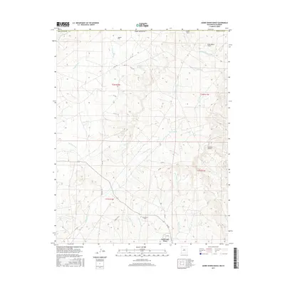
2017 Map of Adobe Downs Ranch
USGS Topo · Published 2017About this map
Adobe Downs Ranch and the surrounding high desert terrain define this landscape in northern San Juan County, near the New Mexico-Colorado border. This modern survey illustrates a network of ephemeral watercourses and local ranching infrastructure, including McDermott Ditch and numerous arroyos such as Jaquez Arroyo and Barton Arroyo. The area is characterized by distinct geological depressions and glades, most notably Farmington Glade and Martin Glade, which cut through the tablelands of Jaquez Flat. Localized industry and utility management are evident at the North Light Plant in the southern portion of the quadrangle. Transportation is primarily handled via a grid of numbered roads and Railroad 3160, which bisects the western reaches near Blue Lake Wash.
Find a feature on this map
43 named features on this map. Tap any name to fly to it.
Don’t see what you’re looking for? This feature index may not catch every label — zoom into the map to look around manually.
Map Details
Editions of this 2017 Adobe Downs Ranch Map
This is the sole edition of this map. No revisions or reprints were ever made.
Other maps of this area

1889 · Largo
USGS Topo · 1:250,000

1889 · Chaco
USGS Topo · 1:250,000

1892 · Chaco
USGS Topo · 1:250,000

1895 · Largo
USGS Topo · 1:250,000

1908 · Ignacio
USGS Topo · 1:125,000

1913 · Red Mesa
USGS Topo · 1:62,500

1924 · Ignacio
USGS Topo · 1:125,000

1945 · Durango
USGS Topo · 1:250,000

1953 · Durango
USGS Topo · 1:250,000

1954 · Durango
USGS Topo · 1:250,000