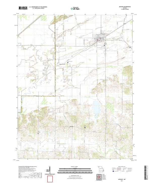
2021 Map of Advance
USGS Topo · Published 2021About this map
The town of Advance serves as the primary hub in this Missouri landscape, situated near the intersection of several regional routes and surrounded by local landmarks like Morgan Memorial Park Cem and Saint Joseph Cem. The map illustrates a transition from the lower-lying agricultural lands to the more varied topography of the Goose Pond Hills in the north. This area is defined by its water management systems, notably the Castor River Diversion Channel and Tilley Ditch, which redirected the flow of the Upper Castor River to support the local economy.
Find a feature on this map
66 named features on this map. Tap any name to fly to it.
Don’t see what you’re looking for? This feature index may not catch every label — zoom into the map to look around manually.
Map Details
Editions of this 2021 Advance Map
This is the sole edition of this map. No revisions or reprints were ever made.
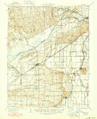
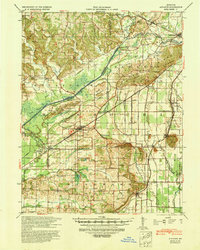
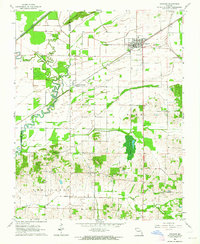
Historical Maps of Castor Through Time
4 maps found