1970 Map of Agate
USGS Topo · Published 1973About this map
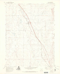
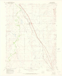
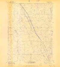
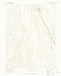
Agate sits as a central railroad node in the early 1970s, defined by its position along the Union Pacific line as it cuts southeast across the high plains of Elbert County. The landscape is a network of ephemeral watercourses and livestock infrastructure, where East Bijou Creek and Agate Creek weave through the terrain. Evidence of the local agricultural economy is visible in the clusters of Storage Bins and the Water Tank near the tracks, essential markers for steam-era remnants and modern freight operations.
Find a feature on this map
12 named features on this map. Tap any name to fly to it.
Don’t see what you’re looking for? This feature index may not catch every label — zoom into the map to look around manually.
Map Details
Editions of this 1970 Agate Map
3 editions found
Other maps of this area

1891 · Limon
USGS Topo · 1:125,000

1892 · Limon
USGS Topo · 1:125,000

1953 · Denver
USGS Topo · 1:250,000

1954 · Limon
USGS Topo · 1:250,000

1957 · Denver
USGS Topo · 1:250,000

1957 · Limon
USGS Topo · 1:250,000

1958 · Limon
USGS Topo · 1:250,000

1958 · Denver
USGS Topo · 1:250,000

1960 · Denver
USGS Topo · 1:250,000
1968 · Deer Trail
USGS Topo · 1:24,000