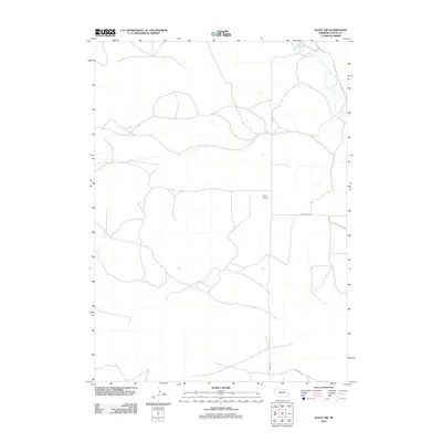
2011 Map of Agate NW
USGS Topo · Published 2011About this map
The Niobrara River winds through the northeastern corner of this western Nebraska landscape, defining the local hydrology within the High Plains. This sparsely settled region in Sioux County is characterized by a network of rural routes, including Morrill Rd and Panhandle Rd, which facilitate movement between isolated homesteads and ranches. A significant landmark on this sheet is the Agate Fossil Beds, an area globally recognized for its significant paleontological history and preserved Miocene-era mammalian remains. The presence of Kaan Airport provides a modern transit point for this remote ranching territory, while Murphy Rd provides access to the southern reaches of the quadrangle. The map illustrates a landscape where cattle ranching and geological preservation exist side by side.
Find a feature on this map
6 named features on this map. Tap any name to fly to it.
Don’t see what you’re looking for? This feature index may not catch every label — zoom into the map to look around manually.
Map Details
Editions of this 2011 Agate NW Map
This is the sole edition of this map. No revisions or reprints were ever made.
Other maps of this area

1896 · Patrick
USGS Topo · 1:125,000

1899 · Whistle Creek
USGS Topo · 1:125,000

1954 · Torrington
USGS Topo · 1:250,000

1955 · Alliance
USGS Topo · 1:250,000

1957 · Alliance
USGS Topo · 1:250,000

1958 · Torrington
USGS Topo · 1:250,000

1958 · Alliance
USGS Topo · 1:250,000

1974 · Spoon Butte
USGS Topo · 1:24,000

1977 · Van Tassell SE
USGS Topo · 1:24,000
1978 · Torrington
USGS Topo · 1:100,000