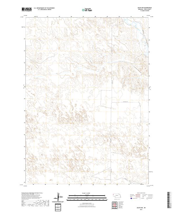
2021 Map of Agate NW
USGS Topo · Published 2021About this map
The Niobrara River flows through the northern reaches of this high plains landscape in Sioux County, carving a distinct path through the terrain. This corner of Nebraska is characterized by its open range and a sparse network of section-line roads, such as Morrill Rd and Panhandle Rd, which define the ranching boundaries of the region. Published by the U.S. Geological Survey, the map illustrates the Public Land Survey System divisions, including t29n r57w and t28n r56w, which have dictated land ownership and usage since the era of original settlement. The topography is marked by subtle drainage patterns and localized high points that influenced the placement of travel routes like Murphy Rd in the southern portion of the quadrangle.
Find a feature on this map
8 named features on this map. Tap any name to fly to it.
Don’t see what you’re looking for? This feature index may not catch every label — zoom into the map to look around manually.
Map Details
Editions of this 2021 Agate NW Map
This is the sole edition of this map. No revisions or reprints were ever made.
Other maps of this area

1896 · Patrick
USGS Topo · 1:125,000

1899 · Whistle Creek
USGS Topo · 1:125,000

1954 · Torrington
USGS Topo · 1:250,000

1955 · Alliance
USGS Topo · 1:250,000

1957 · Alliance
USGS Topo · 1:250,000

1958 · Torrington
USGS Topo · 1:250,000

1958 · Alliance
USGS Topo · 1:250,000

1974 · Spoon Butte
USGS Topo · 1:24,000

1977 · Van Tassell SE
USGS Topo · 1:24,000
1978 · Torrington
USGS Topo · 1:100,000