
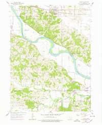
1956 Map of Agency
USGS Topo · Published 1958About this map
The Des Moines River carves a winding path through this mid-century landscape of Agency and its rural environs in southeastern Iowa. This map documents a dense network of country education and faith, recording numerous local landmarks including the Alpine Log Ch and Miller Chapel. The presence of several namesake institutions, such as O'Connor Sch, Hubler Sch, and Betterton Sch, highlights the importance of these small community hubs before later school consolidations altered the social geography of Wapello and Davis Counties.
Find a feature on this map
32 named features on this map. Tap any name to fly to it.
Don’t see what you’re looking for? This feature index may not catch every label — zoom into the map to look around manually.
Map Details
Editions of this 1956 Agency Map
2 editions found
Other maps of this area

1954 · Centerville
USGS Topo · 1:250,000

1954 · Des Moines
USGS Topo · 1:250,000

1956 · Des Moines
USGS Topo · 1:250,000

1956 · Farson
USGS Topo · 1:24,000

1956 · Ottumwa North
USGS Topo · 1:62,500

1956 · Ottumwa South
USGS Topo · 1:24,000

1956 · Ottumwa South
USGS Topo · 1:62,500

1956 · Ottumwa North
USGS Topo · 1:24,000

1957 · Des Moines
USGS Topo · 1:250,000

1957 · Centerville
USGS Topo · 1:250,000