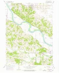
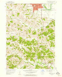
1956 Map of Agency
USGS Topo · Published 1978About this map
The Des Moines River carves a winding path through the heart of the Iowa landscape shown here, serving as a corridor for major transportation lines including the Chicago Rock Island and Pacific and the Chicago Burlington and Quincy railroads. The settlement of Agency stands as a primary hub near the northern border, while smaller points like Cliffland sit directly along the river's bend. This mid-century topography reveals a rural society structured around local gathering points, evidenced by a high density of country schools such as O'Connor Sch and Hubler Sch.
Find a feature on this map
31 named features on this map. Tap any name to fly to it.
Don’t see what you’re looking for? This feature index may not catch every label — zoom into the map to look around manually.
Map Details
Editions of this 1956 Agency Map
2 editions found
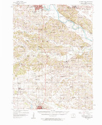
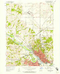
Other maps of this area

1954 · Centerville
USGS Topo · 1:250,000

1954 · Des Moines
USGS Topo · 1:250,000

1956 · Des Moines
USGS Topo · 1:250,000
1956 · Farson
USGS Topo · 1:24,000
1956 · Agency
USGS Topo · 1:24,000
1956 · Ottumwa North
USGS Topo · 1:62,500
1956 · Ottumwa South
USGS Topo · 1:24,000
1956 · Ottumwa South
USGS Topo · 1:62,500
1956 · Ottumwa North
USGS Topo · 1:24,000

1957 · Des Moines
USGS Topo · 1:250,000