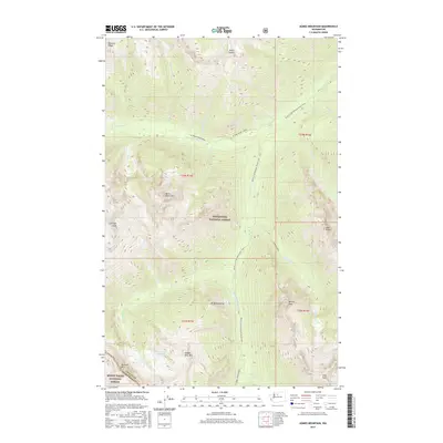
2017 Map of Agnes Mountain
USGS Topo · Published 2017About this map
Agnes Mountain and the high ridges of the North Cascades dominate this 2017 survey of the boundary between Chelan and Snohomish counties. The landscape is defined by its dramatic verticality, with prominent summits like Gunsight Peak, Bannock Mtn, and the Seven Sisters rising above deep glaciated valleys. The primary human corridor through this wilderness is the Pacific Crest National Scenic Trail, which winds northward through the terrain, following the drainage of S Fork Agnes Creek and W Fork Agnes Creek. These watercourses, along with others like Glacier Creek and Spruce Creek, underscore the primitive and protected nature of the area. Included within both the Wenatchee National Forest and the Mount Baker National Forest, the map records a high-altitude ecosystem where features like Bannock Lakes and Saddle Bow Mtn remain accessible only by foot or pack animal.
Find a feature on this map
33 named features on this map. Tap any name to fly to it.
Don’t see what you’re looking for? This feature index may not catch every label — zoom into the map to look around manually.
Map Details
Editions of this 2017 Agnes Mountain Map
This is the sole edition of this map. No revisions or reprints were ever made.
Other maps of this area

1899 · Glacier Peak
USGS Topo · 1:125,000

1901 · Glacier Peak
USGS Topo · 1:125,000

1902 · Stehekin
USGS Topo · 1:125,000

1904 · Stehekin
USGS Topo · 1:125,000

1944 · Holden
USGS Topo · 1:62,500

1949 · Holden
USGS Topo · 1:62,500

1950 · Glacier Peak
USGS Topo · 1:62,500

1955 · Concrete
USGS Topo · 1:250,000

1958 · Concrete
USGS Topo · 1:250,000

1962 · Concrete
USGS Topo · 1:250,000