
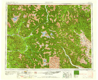
1958 Map of Concrete
USGS Topo · Published 1958About this map
Mt Baker and the high peaks of the North Cascades dominate this mid-century landscape, where river valleys provide the only corridors for settlement and transit. Along the Skagit River, the community of Concrete serves as a western gateway, while the Great Northern RR traces the valley through Hamilton and Rockport. The map illustrates a transitional era for the region's wilderness, showing the established Ross Lake and Lake Shannon reservoirs alongside the vast timberlands of the Mt Baker National Forest and Chelan National Forest. In the deep interior, remote outposts like Stehekin at the head of Lake Chelan and Holden near the Holden Mine represent the isolated mining and mountain communities of the 1950s. The network of trails and fire lookouts throughout the Okanogan National Forest underscores the era's reliance on manual forest management before modern infrastructure reached these high-elevation summits.
Find a feature on this map
66 named features on this map. Tap any name to fly to it.
Don’t see what you’re looking for? This feature index may not catch every label — zoom into the map to look around manually.
Map Details
Editions of this 1958 Concrete Map
2 editions found
Other maps of this area

1895 · Snohomish
USGS Topo · 1:125,000

1897 · Seattle
USGS Topo · 1:125,000

1899 · Glacier Peak
USGS Topo · 1:125,000

1899 · Stillaguamish
USGS Topo · 1:125,000

1899 · Methow
USGS Topo · 1:125,000

1901 · Glacier Peak
USGS Topo · 1:125,000

1901 · Chelan
USGS Topo · 1:125,000

1901 · Stilaguamish
USGS Topo · 1:125,000

1901 · Methow
USGS Topo · 1:125,000

1901 · Chiwaukum
USGS Topo · 1:125,000