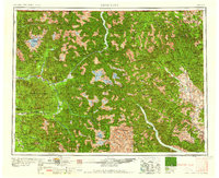
1958 Map of Concrete
USGS Topo · Published 1958About this map
The Skagit River and its major tributaries define the character of this 1950s terrain, flowing through the heart of the Mt Baker National Forest. Along the river valley, small settlements such as Concrete, Birdsview, Rockport, and Marblemount serve as gateways to the high peaks of the North Cascades. The map shows the industrial and transit footprint of the Great Northern railroad as it follows the valley floor, connecting these timber and resource outposts.
Find a feature on this map
53 named features on this map. Tap any name to fly to it.
Don’t see what you’re looking for? This feature index may not catch every label — zoom into the map to look around manually.
Map Details
Editions of this 1958 Concrete Map
2 editions found

Other maps of this area

1895 · Snohomish
USGS Topo · 1:125,000

1897 · Seattle
USGS Topo · 1:125,000

1899 · Glacier Peak
USGS Topo · 1:125,000

1899 · Stillaguamish
USGS Topo · 1:125,000

1899 · Methow
USGS Topo · 1:125,000

1901 · Glacier Peak
USGS Topo · 1:125,000

1901 · Chelan
USGS Topo · 1:125,000

1901 · Stilaguamish
USGS Topo · 1:125,000

1901 · Methow
USGS Topo · 1:125,000

1901 · Chiwaukum
USGS Topo · 1:125,000