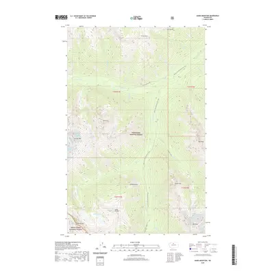
2020 Map of Agnes Mountain
USGS Topo · Published 2020About this map
Agnes Mtn stands as a central topographic anchor in this portion of the high Cascades, where the Wenatchee National Forest meets the Mount Baker National Forest. This high-altitude landscape is defined by its glacial activity and drainage patterns, specifically the several glaciers that feed the headwaters of Agnes Creek and its tributaries. The Pacific Crest National Scenic Trail traverses the eastern half of the map, following the contours of the S Fork Agnes Creek valley before ascending toward Lyall Ridge. To the south and west, the terrain rises to notable summits including Gunsight Peak and Bannock Mtn. Significant ice fields such as Chickamin Glacier and Blue Glacier illustrate the ongoing glacial processes at the Chelan and Snohomish County border, providing a precise look at the cryosphere and hydrology of the region in the early twenty-first century.
Find a feature on this map
40 named features on this map. Tap any name to fly to it.
Don’t see what you’re looking for? This feature index may not catch every label — zoom into the map to look around manually.
Map Details
Editions of this 2020 Agnes Mountain Map
This is the sole edition of this map. No revisions or reprints were ever made.
Other maps of this area

1899 · Glacier Peak
USGS Topo · 1:125,000

1901 · Glacier Peak
USGS Topo · 1:125,000

1902 · Stehekin
USGS Topo · 1:125,000

1904 · Stehekin
USGS Topo · 1:125,000

1944 · Holden
USGS Topo · 1:62,500

1949 · Holden
USGS Topo · 1:62,500

1950 · Glacier Peak
USGS Topo · 1:62,500

1955 · Concrete
USGS Topo · 1:250,000

1958 · Concrete
USGS Topo · 1:250,000

1962 · Concrete
USGS Topo · 1:250,000